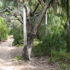
Clarkes Road Gemfields
Location: Lowmead
Location: Gladstone Regional
GPS coordinates: -24.50985,151.70979
Latest update: November 22, 2025 08:04
Deepwater National Park
32.2 km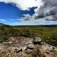
Eurimbula National Park
34.2 km
Mount Colosseum National Park
17 km
Littabella National Park
34.6 km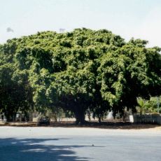
Big Fig, Miriam Vale
25 km
Bulburin National Park
25.6 km
Warro National Park
15.4 km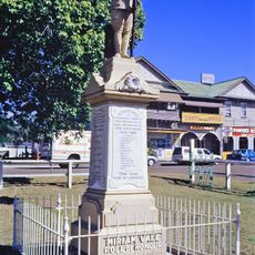
Miriam Vale War Memorial
25 km
Agnes Water Museum
38.9 km
Rules Beach
33.5 km
Lazy Lizard Surf School
38.9 km
Springs Beach
38.4 km
Agnes Water Art Gallery
33.6 km
Paperbark Forest Boardwalk
37.6 km
Miriam Vale Golf Course
25 km
Red Rock Walking Trail Carpark
38.1 km
Red Rock Trail End
37.2 km
Sunrise Beach
38.2 km
Honeymoon Bay
38.3 km
1770 Golf Course and Driving Range
33.5 km
Ganoonga Noonga Lookout
35.9 km
Scenic viewpoint
33.3 km
Rocky Point
38.5 km
Scenic viewpoint
39 km
Scenic viewpoint
38.2 km
Old Miriam Vale Bank
25.1 km
Hertiage Fig Tree
25 km
War Memorial
25 kmReviews
Visited this place? Tap the stars to rate it and share your experience / photos with the community! Try now! You can cancel it anytime.
Discover hidden gems everywhere you go!
From secret cafés to breathtaking viewpoints, skip the crowded tourist spots and find places that match your style. Our app makes it easy with voice search, smart filtering, route optimization, and insider tips from travelers worldwide. Download now for the complete mobile experience.

A unique approach to discovering new places❞
— Le Figaro
All the places worth exploring❞
— France Info
A tailor-made excursion in just a few clicks❞
— 20 Minutes