Tongue Point Track
Location: Wilsons Promontory
Location: Shire of South Gippsland
GPS coordinates: -38.98501,146.27198
Latest update: October 11, 2024 01:42
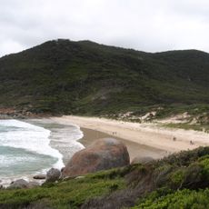
Squeaky Beach
5.3 km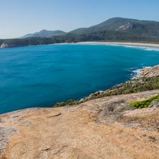
Norman Beach
6.1 km
Cotters Beach
5.7 km
Mount Leonard
4.3 km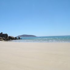
Darby Beach
1.8 km
Sparkes Lookout
2.2 km
Wilsons Promontory National Park, Wilsons Promontory, Australia
718 m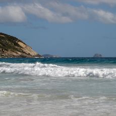
Picnic Bay - Wilsons Promontory
3.9 km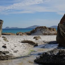
Whisky Bay -Norman Island
3.3 km
Scenic viewpoint
3.7 km
Darby beach
1.3 km
Sparkes Lookout
1.9 km
Whisky Bay
3.5 km
Tongue Point
1.9 km
View
1.6 km
Picnic Bay
4 km
Norman Lookout
4.1 km
Glennie Lookout
4.3 km
Darby Saddle
3.1 km
Lookout Rocks
1.1 km
Scenic viewpoint
5.5 km
Fairy Cove
874 m
Cotters Beach
5.8 km
Tidal Overlook
6 km
Scenic viewpoint
6 km
Fairy Cove
795 m
Whale Rock
6.2 km
Scenic viewpoint
6.2 kmReviews
Visited this place? Tap the stars to rate it and share your experience / photos with the community! Try now! You can cancel it anytime.
Discover hidden gems everywhere you go!
From secret cafés to breathtaking viewpoints, skip the crowded tourist spots and find places that match your style. Our app makes it easy with voice search, smart filtering, route optimization, and insider tips from travelers worldwide. Download now for the complete mobile experience.

A unique approach to discovering new places❞
— Le Figaro
All the places worth exploring❞
— France Info
A tailor-made excursion in just a few clicks❞
— 20 Minutes