Tuggeranong Homestead
Location: Richardson
Location: District of Tuggeranong
GPS coordinates: -35.43089,149.11068
Latest update: November 22, 2025 19:54
Tuggeranong Town Centre
4.3 km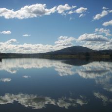
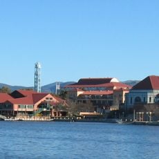
Lake Tuggeranong
4.7 km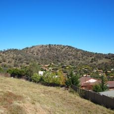
Tuggeranong Hill
2.5 km
Pine Island Reserve
3.7 km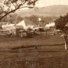
Tuggeranong Homestead
31 m
Mount Wanniassa
4.4 km
Southern Cross Stadium, Tuggeranong
4.7 km
Simpsons Hill
1.8 km
Nguru Beach
4.6 km
Tuggeranong Town Park Beach
4.7 km
Mundang Beach
4.6 km
Ngadyung Beach
4.8 km
Hannah Community Park
2.6 km
Tuggeranong Town Park
4.7 km
Gordonvale Park
4.3 km
Farrer Ridge Nature Reserve
4.9 km
Wanniassa Hills Nature Reserve
4.9 km
Tuggeranong Schoolhouse
2.1 km
Wanniassa observatory
4.7 km
Angel Wings
3.9 km
Statue, Work of art
4.3 km
Statue, Work of art
4.3 km
Scenic viewpoint
5 km
Monks Pulpit
3.8 km
Oxley Hill Outlook
3.8 km
National Service
4.6 km
Francis Greenway Memorial
4.2 km
Theodore Grinding Grooves
2.1 kmReviews
Visited this place? Tap the stars to rate it and share your experience / photos with the community! Try now! You can cancel it anytime.
Discover hidden gems everywhere you go!
From secret cafés to breathtaking viewpoints, skip the crowded tourist spots and find places that match your style. Our app makes it easy with voice search, smart filtering, route optimization, and insider tips from travelers worldwide. Download now for the complete mobile experience.

A unique approach to discovering new places❞
— Le Figaro
All the places worth exploring❞
— France Info
A tailor-made excursion in just a few clicks❞
— 20 Minutes