Enable Location

We need your location to show you interesting places around you

Discover nearby places

Find interesting locations and hidden gems around you

Precise directions

Get accurate directions and distances to places

Your location is never shared with other users. It's only used when you tap the location button.

Tuggeranong Hill

Log in to your account

Start exploring — it's free

Trusted by 63,233 travelers worldwide

Continue with Google
Continue with Apple
or

We will send you a code to connect

By continuing, you accept our Terms and Conditions and our Privacy Policy

Check your inbox

We've sent a pincode in your inbox. Please enter the code below.

Tuggeranong Hill
Discussion Reviews 1 Photos
2.4k Popularity

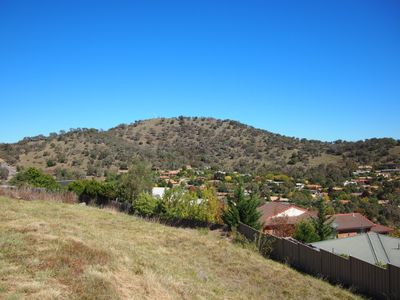
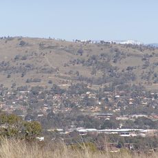
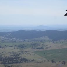
Tuggeranong Hill, Natural summit in Tuggeranong Valley, Australia.

Tuggeranong Hill is a wooded summit near Canberra with a peak elevation of around 874 meters. A walking track winds through the reserve, passing through woodland areas to reach the top.

The nature reserve was established in 1993 to protect native woodland that survived after nearby farm estates were developed. The area held significance for indigenous communities for countless generations.

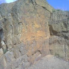
The Ngunnawal people have deep roots in this landscape, with grinding marks on rocks showing their long presence here. Walking through the reserve, visitors can see these marks and understand how meaningful this place has been for its original inhabitants.

Access to the walking track starts at the Callister Crescent car park and follows a clearly marked route with moderate inclines. The path is easy to walk and requires no special skills or equipment.

The reserve is home to rare bird species like Glossy Black-cockatoos and contains threatened woodland types. This mix of uncommon wildlife and plant life makes the place valued by nature watchers.

The community of curious travelers

AroundUs brings together thousands of curated places, local tips, and hidden gems, enriched daily by 60,000 contributors worldwide.

Start exploring
GPS coordinates
-35.45315,149.10771
Latest update
December 13, 2025 11:44
Reviews
Share your experience

No review yet

Discussions
Start a discussion...

No discussion yet

« Tuggeranong Hill - Natural summit in Tuggeranong Valley, Australia » is provided by Around Us (aroundus.com). Images and texts are derived from Wikimedia project under a Creative Commons license. You are allowed to copy, distribute, and modify copies of this page, under the conditions set by the license, as long as this note is clearly visible.

Discover hidden gems everywhere you go!

From secret cafés to breathtaking viewpoints, skip the crowded tourist spots and find places that match your style. Our app makes it easy with voice search, smart filtering, route optimization, and insider tips from travelers worldwide. Download now for the complete mobile experience.

Around Us App Screenshot

A unique approach to discovering new places

Le Figaro

All the places worth exploring

France Info

A tailor-made excursion in just a few clicks

20 Minutes

Around Us
Travel Guide & Maps
Download

Send to your phone

QR Code
1

Open the camera app on your mobile.

2

Point at the QR code with your camera. A notification will appear.

3

Tap the notification to open the link.