The Blue Gate
Location: Moulamein
Location: Edward River Council
GPS coordinates: -35.17727,144.35014
Latest update: November 21, 2025 19:10
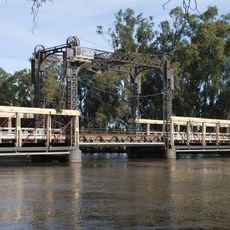
Barham Bridge over Murray River
54.4 km
Pioneer Park
53.1 km
Jacksons Weir
52.9 km
Peppin Park
30.5 km
Mortimers Weir
59.7 km
Fish Point Weir
60.6 km
Stevens Weir
47.4 km
Yallakool Weir
48.8 km
Wakool Weir
51.9 km
Koondrook Weir
57.2 km
Colligen Weir
42.6 km
Camerons Weir
49.6 km
Benjeroop Weir
57.4 km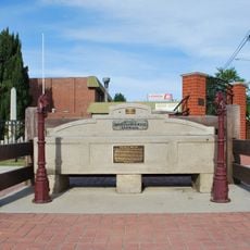
Horse trough
54.3 km
Condidorios Bridge
56.2 km
Yallakool Creek Weir
47.4 km
Koondrook Tram Complex
55.4 km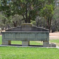
Horse trough
30.4 km
Barham Golf Resort
52.1 km
Murrabit Golf Course
53.6 km
Moulamein Heritage Village - Wool Wheat Rice
30.8 km
Long Paddock
41.4 km
Peppin Ram Memorial
42.7 km
Site of First Rice Farm
29.2 km
Memorial to Frederick York Wolseley
40.3 km
Stock yard
54 km
Memorial
30.4 km
Noorong Early Settlers Memorial
34.3 kmReviews
Visited this place? Tap the stars to rate it and share your experience / photos with the community! Try now! You can cancel it anytime.
Discover hidden gems everywhere you go!
From secret cafés to breathtaking viewpoints, skip the crowded tourist spots and find places that match your style. Our app makes it easy with voice search, smart filtering, route optimization, and insider tips from travelers worldwide. Download now for the complete mobile experience.

A unique approach to discovering new places❞
— Le Figaro
All the places worth exploring❞
— France Info
A tailor-made excursion in just a few clicks❞
— 20 Minutes