The Round House
Location: Murray Bridge
Location: The Rural City of Murray Bridge
GPS coordinates: -35.11647,139.27824
Latest update: November 3, 2025 14:03
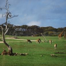
Monarto Zoo
11.4 km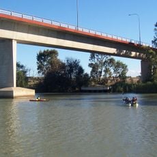
Swanport Bridge
4.5 km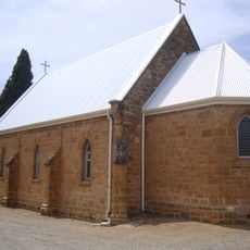
St John the Baptist Cathedral, Murray Bridge
584 m
Ferries-McDonald Conservation Park
18 km
Ferries-McDonald Conservation Park
18 km
McNamara Park
1.3 km
Avoca Dell Picnic Grounds
4.1 km
Irene Hughes Park
10.9 km
Gifford Hill
6.9 km
Disher Hill
20.3 km
Kays Hill
20.2 km
Bretag Farm Ruins
10.9 km
Sunnyside Lookout
12.1 km
Bunyip
779 m
Murray Bridge Golf Club
2 km
Ferries McDonald Loop Trail Parking
19 km
Old Tailem Town
17.8 km
Murray Bridge Olympic Pool
968 m
Bridge Arts
153 m
Frank Jackman Lookout
4.7 km
Mannum Golf Club
21.3 km
Giraffe Viewing Platform
11.2 km
Scenic viewpoint
4.8 km
Memorial
531 m
Ruins
18.4 km
Ruins
16.9 km
Ruins
16 km
Abandoned Car
11.9 kmReviews
Visited this place? Tap the stars to rate it and share your experience / photos with the community! Try now! You can cancel it anytime.
Discover hidden gems everywhere you go!
From secret cafés to breathtaking viewpoints, skip the crowded tourist spots and find places that match your style. Our app makes it easy with voice search, smart filtering, route optimization, and insider tips from travelers worldwide. Download now for the complete mobile experience.

A unique approach to discovering new places❞
— Le Figaro
All the places worth exploring❞
— France Info
A tailor-made excursion in just a few clicks❞
— 20 Minutes