Meridiánový kámen
Location: Haugschlag
Operator: Gemeinde Haugschlag
GPS coordinates: 48.99935,14.99901
Latest update: November 12, 2025 09:22
Ancient and Primeval Beech Forests of the Carpathians and Other Regions of Europe
102 m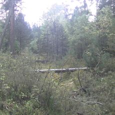
Losí blato u Mirochova
3 km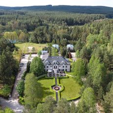
Hotel Peršlák
3 km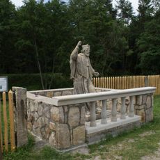
Socha svatého Jana Nepomuckého na hrázi Novomlýnského rybníka u hotelu Peršlák
3.1 km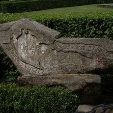
Kámen republiky
3 km
Lípa u lomu
3.4 km
Buk na Skalkách
3.3 km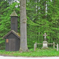
Glockenturm
2.8 km
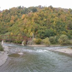
Koštěnický potok
3.3 km
Kámen republiky
3 km
Wayside shrine
3 km
Work of art, statue
3.1 km
Sculpture, Work of art
2.7 km
Work of art, sculpture
2.7 km
Zachovalá původní brána signálky
2.1 km
Černý kříž
1.8 km
Pomník
1.2 km
Dr. Has
3 km
Statue, Work of art
3.1 km
Wayside cross, Christianity
1.9 km
Wayside shrine, Christianity
2.1 km
Catholic church building, wayside cross, Christianity
2.8 km
Memorial, war memorial
2.8 km
Wayside shrine, Christianity
1.9 km
Sv. Josef
1.5 km
Memorial
1.4 km
Wayside shrine, Christianity
2.1 km
185/287/A-220
3.3 kmReviews
Visited this place? Tap the stars to rate it and share your experience / photos with the community! Try now! You can cancel it anytime.
Discover hidden gems everywhere you go!
From secret cafés to breathtaking viewpoints, skip the crowded tourist spots and find places that match your style. Our app makes it easy with voice search, smart filtering, route optimization, and insider tips from travelers worldwide. Download now for the complete mobile experience.

A unique approach to discovering new places❞
— Le Figaro
All the places worth exploring❞
— France Info
A tailor-made excursion in just a few clicks❞
— 20 Minutes