Opferschalen
Location: Waldhausen im Strudengau
GPS coordinates: 48.27886,14.98478
Latest update: November 13, 2025 22:05
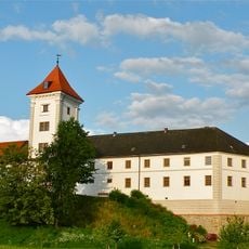
Stift Waldhausen
2.3 km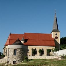
Parish church of Waldhausen im Strudengau
2.7 km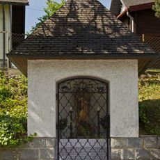
Flur-/Wegkapelle
3 km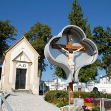
Cemetery cross in Waldhausen im Strudengau
2.7 km
Figurenbildstock Gnadenstuhl, Waldhausen im Strudengau
2.7 km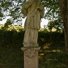
Figur hl. Johannes Nepomuk
2.3 km
Ehemaliges Augustinerchorherrenkloster, Schultrakt des Klosters
2.4 km
Figurenbildstock Maria Immaculata
2.6 km
Einsiedlerhöhle ("hermit's cave")
816 m
Pfarrhof, Waldhausen im Strudengau
2.5 km
Persönlichkeitsdenkmal Kaiser Franz Josef I
2.5 km
Schwingender Stein bei Waldhausen
24 m
Miethaus, ehemaliges Spital
2.4 km
Ereignisdenkmal
2.1 km
Schwingender Stein
77 m
Einsiedlerhöhle
807 m
Falkenmauer
1.3 km
Work of art
1.7 km
Heimkehrerkreuzwarte (Aussichtsturm)
1.7 km
Schafstein
705 m
Scenic viewpoint
1.3 km
Nepomuk
2.3 km
Wayside cross
3.2 km
Wayside shrine
2.6 km
Wayside shrine
3 km
Wayside shrine
3.4 km
Wayside shrine
2.5 km
Wayside shrine
2 kmReviews
Visited this place? Tap the stars to rate it and share your experience / photos with the community! Try now! You can cancel it anytime.
Discover hidden gems everywhere you go!
From secret cafés to breathtaking viewpoints, skip the crowded tourist spots and find places that match your style. Our app makes it easy with voice search, smart filtering, route optimization, and insider tips from travelers worldwide. Download now for the complete mobile experience.

A unique approach to discovering new places❞
— Le Figaro
All the places worth exploring❞
— France Info
A tailor-made excursion in just a few clicks❞
— 20 Minutes