Der Halbe Weg
Location: Vorderweißenbach
GPS coordinates: 48.59005,14.17209
Latest update: November 13, 2025 07:29
Spáleniště
1.5 km
Multerberské rašeliniště
2.7 km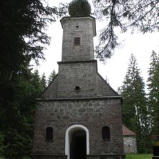
Forest chapel Maria Rast
3.4 km
Braukeller Hinterweissenbach
2.1 km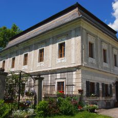
Neues Löfflergut, Vorderweißenbach
2 km
Lípa Spáleniště
339 m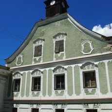
Altes Löfflergut, Hinterweißenbach
2.1 km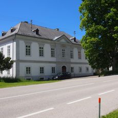
Taverne Hinterweißenbach
2.1 km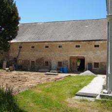
Brauhaus
2.1 km
Wayside shrine
1 km
Wayside shrine
3 km
Obernhausermarterl
2 km
Guglermarterl
1.5 km
Wayside shrine
1.1 km
Iron Curtain Memorial
592 m
Liedl Kreuz
3.3 km
Steinerne Heuschober
1.8 km
Wayside cross
2.9 km
Scenic viewpoint
3.4 km
Wayside cross
2.6 km
Wayside shrine, Christianity
1.4 km
Wayside shrine, Christianity
1.8 km
Wayside cross
3.1 km
Kapellen Friedhof
3.3 km
Pfarre Kapellen
3.3 km
Wayside cross, Christianity, Catholic church building
1.1 km
Wayside cross, Christianity
3.4 km
Ruins
3.3 kmReviews
Visited this place? Tap the stars to rate it and share your experience / photos with the community! Try now! You can cancel it anytime.
Discover hidden gems everywhere you go!
From secret cafés to breathtaking viewpoints, skip the crowded tourist spots and find places that match your style. Our app makes it easy with voice search, smart filtering, route optimization, and insider tips from travelers worldwide. Download now for the complete mobile experience.

A unique approach to discovering new places❞
— Le Figaro
All the places worth exploring❞
— France Info
A tailor-made excursion in just a few clicks❞
— 20 Minutes