Kalkofen
Location: Sölk
Website: https://www.ennstalwiki.at/wiki/index.php/Kalkofen
Website: https://ennstalwiki.at/wiki/index.php/Kalkofen
GPS coordinates: 47.31381,14.04052
Latest update: November 17, 2025 19:45
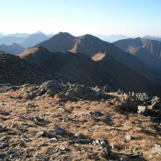
Rettelkirchspitze
8.9 km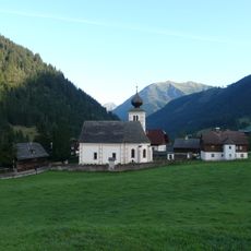
Pfarrkirche hl. Nikolaus, Sankt Nikolai im Sölktal
738 m
Ahornkogl
6.6 km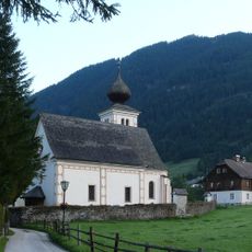
Friedhof mit Initienkapellen
755 m
Heimatmuseum Sankt Nikolai im Sölktal
789 m
Bauernhof Bergler, Sankt Nikolai im Sölktal
1.1 km
Riesnerkrispen
6.9 km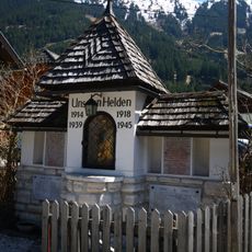
Kriegerdenkmal
783 m
Wayside shrine, Christianity
8.9 km
Memorial
4.8 km
Scenic viewpoint
4.2 km
Limberger
6.2 km
Place of worship, wayside shrine, house of prayer
6.7 km
Place of worship, wayside shrine, Christianity, house of prayer
8.6 km
Deer
7.3 km
Christianity, Catholic church building, wayside cross
8.7 km
Wayside shrine
4.6 km
Aussichtspunkt Katschtalkehre
6.8 km
Christianity, Catholic church building, wayside cross
1.4 km
Commemorative plaque, memorial
8.3 km
Memorial
4.3 km
Wayside cross
828 m
Waterfall
2.6 km
Waterfall
4.2 km
Waterfall
4.2 km
Dürrmoos Wasserfall
2.6 km
Waterfall
6.3 km
Waterfall
6.6 kmReviews
Visited this place? Tap the stars to rate it and share your experience / photos with the community! Try now! You can cancel it anytime.
Discover hidden gems everywhere you go!
From secret cafés to breathtaking viewpoints, skip the crowded tourist spots and find places that match your style. Our app makes it easy with voice search, smart filtering, route optimization, and insider tips from travelers worldwide. Download now for the complete mobile experience.

A unique approach to discovering new places❞
— Le Figaro
All the places worth exploring❞
— France Info
A tailor-made excursion in just a few clicks❞
— 20 Minutes