
Wihéries Cermetery CWGC Plot
Location: Dour
Website: https://www.cwgc.org/visit-us/find-cemeteries-memorials/cemetery-details/55332/Wiheries%20Communal%20Cemetery/
GPS coordinates: 50.38679,3.74133
Latest update: October 11, 2024 02:20
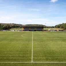
Robert Urbain Stadium
4 km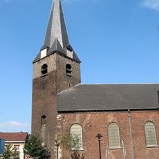
Église Saint-Victor de Dour
2.7 km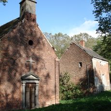
Chapelle de Cocars
1.6 km
Moulin de Montignies-sur-Roc
2.2 km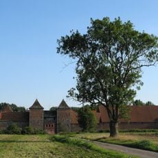
Château-ferme de Rampemont
3.5 km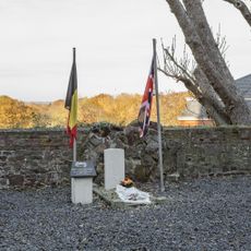
Montignies-sur-Roc Churchyard
1.9 km
Jules Pitot
4.5 km
Scenic viewpoint
4.5 km
City Theatre
2.9 km
Notre-Dame de l’Épinette
3.8 km
Aux Morts WW
2.5 km
Memorial, war memorial
2.1 km
Work of art, installation artwork
2.9 km
Aux Morts WW
2 km
Memorial, war memorial
3.2 km
Memorial, war memorial
3.4 km
Wayside cross
1.9 km
Monuments aux morts
3.7 km
Puits Charbonnage Saint-Antoine
3.7 km
Saint Rita
2.3 km
Statue de Charles Bernier
3.9 km
War memorial, memorial
1.6 km
Chapelle ND de Pitié
1.3 km
Borne de puits de Charbonnage Vedette
4.5 km
Memorial, war memorial
1.1 km
Memorial, war memorial
4.7 km
Wayside cross
4.8 km
Chapelle
4.8 kmReviews
Visited this place? Tap the stars to rate it and share your experience / photos with the community! Try now! You can cancel it anytime.
Discover hidden gems everywhere you go!
From secret cafés to breathtaking viewpoints, skip the crowded tourist spots and find places that match your style. Our app makes it easy with voice search, smart filtering, route optimization, and insider tips from travelers worldwide. Download now for the complete mobile experience.

A unique approach to discovering new places❞
— Le Figaro
All the places worth exploring❞
— France Info
A tailor-made excursion in just a few clicks❞
— 20 Minutes