
Ancienne Gare Les Hautes-Rivières
Location: Les Hautes-Rivières
GPS coordinates: 49.88820,4.83835
Latest update: October 11, 2024 03:06
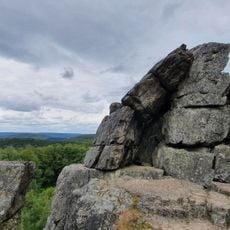
Roc la Tour
3.8 km
Château de Linchamps
2.7 km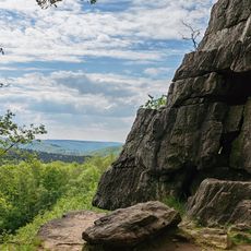
Roc la Tour
3.9 km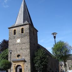
Saint Leodegarius church
4.3 km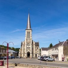
Église Saint-Remi de Thilay
2.8 km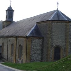
Église Saint-Jean-Baptiste des Hautes-Rivières
586 m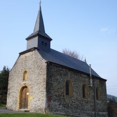
Église de Linchamps
2.6 km
Roche du Saut Thibault
1.7 km
Scenic viewpoint
990 m
La Cuve
4.5 km
Scenic viewpoint
710 m
Point de vue du Jambon
4.5 km
Scenic viewpoint
2.9 km
La Croix
4.1 km
Scenic viewpoint
3.4 km
Dead end street, scenic viewpoint
4.1 km
Scenic viewpoint
4 km
Roche aux Corpias
4 km
La roche Margot
586 m
Memorial, war memorial
1.3 km
La table des fées
3.8 km
Catholic church building, wayside cross, Christianity
3.8 km
Le Pont Cassé
4.1 km
La Cheminée
3.8 km
Roche a Campa
3.3 km
Scenic viewpoint
4.1 km
Work of art, installation artwork
1.4 km
Wayside cross
1.1 kmReviews
Visited this place? Tap the stars to rate it and share your experience / photos with the community! Try now! You can cancel it anytime.
Discover hidden gems everywhere you go!
From secret cafés to breathtaking viewpoints, skip the crowded tourist spots and find places that match your style. Our app makes it easy with voice search, smart filtering, route optimization, and insider tips from travelers worldwide. Download now for the complete mobile experience.

A unique approach to discovering new places❞
— Le Figaro
All the places worth exploring❞
— France Info
A tailor-made excursion in just a few clicks❞
— 20 Minutes