Pont romain
Location: Saint-Léger-la-Montagne
GPS coordinates: 46.02777,1.41748
Latest update: November 16, 2025 05:24

Signal de Sauvagnac
2.7 km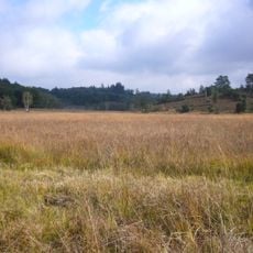
Réserve naturelle nationale de la tourbière des Dauges
1.6 km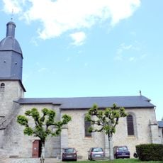
Église Saint-Sylvestre de Saint-Sylvestre
4.7 km
Réserve naturelle régionale des Sauvages
2.9 km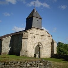
Église Saint-Pierre (Saint-Léger-la-Montagne)
2.1 km
Pierre branlante
3.2 km
Maison de la réserve naturelle nationale de la tourbière des Dauges
2.1 km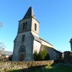
Église Notre-Dame de Sauvagnac
239 m
Grandmont abbey
3.6 km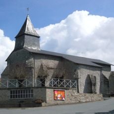
Église Saint-Léger
239 m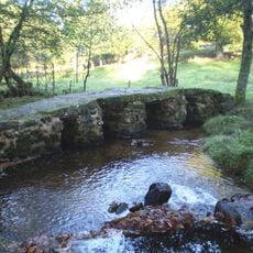
Saint-Léger-la-Montagne Roman bridge
7 m
Motte de l'Age
3.9 km
Scenic viewpoint
3.8 km
Toposcope, scenic viewpoint
3 km
Point de vue sur la tourbière des dauges
1.5 km
Bonne Fontaine Notre-Dame de Sauvagnac
2 km
Loge de berger
1.4 km
Arboretum Domanial
4.6 km
Scenic viewpoint
3.3 km
Scenic viewpoint
3.6 km
Point de vue de la Pierre Branlante
3.2 km
Wayside cross
4.2 km
Motte castrale de l'Age Rideau
3.9 km
Wayside shrine
3.8 km
Memorial
201 m
Notre-Dame de la Salette de Sauvagnac
1.7 km
Ruins
3.7 km
Cascade du Moulin de l'Âge
3.6 kmReviews
Visited this place? Tap the stars to rate it and share your experience / photos with the community! Try now! You can cancel it anytime.
Discover hidden gems everywhere you go!
From secret cafés to breathtaking viewpoints, skip the crowded tourist spots and find places that match your style. Our app makes it easy with voice search, smart filtering, route optimization, and insider tips from travelers worldwide. Download now for the complete mobile experience.

A unique approach to discovering new places❞
— Le Figaro
All the places worth exploring❞
— France Info
A tailor-made excursion in just a few clicks❞
— 20 Minutes