Chest opened
+${chestReward.xp} XP
Explorer
NOUVEAU ×${chestReward.collectible.quantity}
tapez pour fermer
Chest locked

Open chests in the app

Around Us is built for your phone — chests unlock when you walk, explore and capture nearby places.

Enable Location

We need your location to show you interesting places around you

Discover nearby places

Find interesting locations and hidden gems around you

Precise directions

Get accurate directions and distances to places

Your location is never shared with other users. It's only used when you tap the location button.

Log in to your account

Start exploring — it's free

Trusted by 73,025 travelers worldwide

Continue with Google
Continue with Apple
or

We will send you a code to connect

By continuing, you accept our Terms and Conditions and our Privacy Policy

Check your inbox

We've sent a pincode in your inbox. Please enter the code below.

Signal de Sauvagnac
Discussion Reviews Photo
1k Popularity

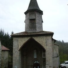
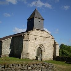
Signal de Sauvagnac, Mountain summit in Saint-Léger-la-Montagne, France.

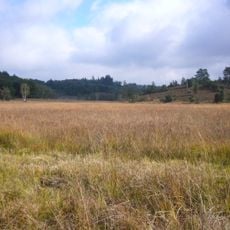
Signal de Sauvagnac is a mountain summit in Saint-Léger-la-Montagne that rises to 702 meters elevation as the highest point of the Monts d'Ambazac. The southern slopes feature marked hiking trails that wind through the landscape and offer sweeping views across the surrounding region.

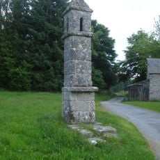
During the 19th century, this location held strategic importance as the site of one of the region's early optical telegraph stations. The hilltop position made it ideal for transmitting signals across long distances.

The summit serves as a meeting point for local hikers who explore the area's trails and enjoy views across the Limousin landscape. The well-used paths show how much this place matters to people who live nearby.

The summit itself is not accessible due to military installations, but the southern slopes provide marked trails for hiking and nature walks. These well-maintained paths allow visitors to explore the area and enjoy the surrounding landscape.

Today a French Air Force radio center operates on the summit as part of the country's airspace surveillance system. This military presence is the reason visitors cannot access the very top of the mountain.

The community of curious travelers

AroundUs brings together thousands of curated places, local tips, and hidden gems, enriched daily by 60,000 contributors worldwide.

Start exploring
GPS coordinates
46.01124,1.44335
Latest update
December 14, 2025 20:05
Reviews
Share your experience

No review yet

Discussions
Start a discussion...

No discussion yet

« Signal de Sauvagnac - Mountain summit in Saint-Léger-la-Montagne, France » is provided by Around Us (aroundus.com). Images and texts are derived from Wikimedia project under a Creative Commons license. You are allowed to copy, distribute, and modify copies of this page, under the conditions set by the license, as long as this note is clearly visible.

Discover hidden gems everywhere you go!

From secret cafés to breathtaking viewpoints, skip the crowded tourist spots and find places that match your style. Our app makes it easy with voice search, smart filtering, route optimization, and insider tips from travelers worldwide. Download now for the complete mobile experience.

Around Us App Screenshot

A unique approach to discovering new places

Le Figaro

All the places worth exploring

France Info

A tailor-made excursion in just a few clicks

20 Minutes

Around Us
Travel Guide & Maps
Download

Send to your phone

QR Code
1

Open the camera app on your mobile.

2

Point at the QR code with your camera. A notification will appear.

3

Tap the notification to open the link.