Წონიარისის თაღოვანი ხიდი
Location: ქედის მუნიციპალიტეტი
GPS coordinates: 41.65682,42.01829
Latest update: November 17, 2025 19:33
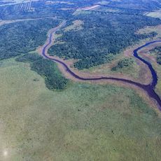
Colchic Rainforests and Wetlands
7.5 km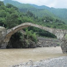
Dandalo Bridge
7.5 km
Akho mosque
3.3 km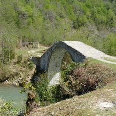
Кобалаури күпере
9.8 km
Აქუცის ხიდი
6.7 km
Ხიჭაურის ციხე
9.5 km
Ზენდიდის ეკლესია
9.6 km
Ოქტომბრის საწნახელი
9.9 km
Ოთოლთის ციხე
10 km
Წონიარისის ხიდი
4 m
Scenic viewpoint
9.7 km
Fortress
9.6 km
Купальни
9.3 km
Keda Top
8.1 km
Merisi waterfall
9.7 km
Scenic viewpoint
9.8 km
Scenic viewpoint
9.8 km
Scenic viewpoint
7.1 km
Სოფელი კოკოტაური
4.4 km
Gulebi fortress
7.1 km
Გეგელიძეების კოშკი (ნანგრევები)
5 km
Კავიანის (ხიჭაურის) ციხე
9.4 km
Ცხმორისის ხიდის ნანგრევები
2.8 km
Waterfall
9.3 km
Waterfall
8.1 km
Გობრონეთის ჩანჩქერი
3.7 km
Dandalo
7.1 km
Waterfall
6.2 kmReviews
Visited this place? Tap the stars to rate it and share your experience / photos with the community! Try now! You can cancel it anytime.
Discover hidden gems everywhere you go!
From secret cafés to breathtaking viewpoints, skip the crowded tourist spots and find places that match your style. Our app makes it easy with voice search, smart filtering, route optimization, and insider tips from travelers worldwide. Download now for the complete mobile experience.

A unique approach to discovering new places❞
— Le Figaro
All the places worth exploring❞
— France Info
A tailor-made excursion in just a few clicks❞
— 20 Minutes