Radio towers
Location: საგარეჯოს მუნიციპალიტეტი
GPS coordinates: 41.86604,45.27882
Latest update: October 15, 2025 22:19
Ikalto monastery
11.1 km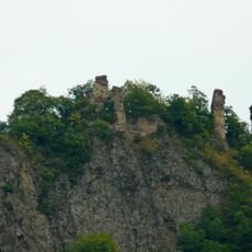
Psiti Castle
7.1 km
Საჩინის ეკლესია
10.2 km
Წმ. გიორგის ეკლესია
10.9 km
Წმ. გიორგის ეკლესია
10.2 km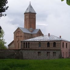
Ღვთისმშობლის ეკლესია
10.7 km
Წმ. გიორგის ეკლესია
10.3 km
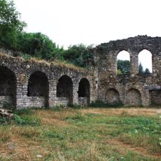
Ruins
10.6 km
Scenic viewpoint
3 km
Ruins
5.3 km
Ruins
5.8 km
Castle
6.5 km
Scenic viewpoint
228 m
Რუსიანის ციხე ეკლესიით (ნანაგრევები)
4.5 km
Wayside cross
222 m
Ამიდასთურის ეკლესია
3 km
Ვერონას ციხე
2.8 km
Ruins
10.6 km
Ruins
5 km
Scenic viewpoint
10.7 km
Rest area, scenic viewpoint
132 m
Scenic viewpoint
114 m
Scenic viewpoint
11.1 km
Wayside shrine, Christianity
11.2 km
Scenic viewpoint
11.4 km
Ნანგრევები
11.6 km
Ruins
11.6 km
Tsifliskhevi Waterfall
11.6 kmReviews
Visited this place? Tap the stars to rate it and share your experience / photos with the community! Try now! You can cancel it anytime.
Discover hidden gems everywhere you go!
From secret cafés to breathtaking viewpoints, skip the crowded tourist spots and find places that match your style. Our app makes it easy with voice search, smart filtering, route optimization, and insider tips from travelers worldwide. Download now for the complete mobile experience.

A unique approach to discovering new places❞
— Le Figaro
All the places worth exploring❞
— France Info
A tailor-made excursion in just a few clicks❞
— 20 Minutes