Obsidian path
Location: ნინოწმინდის მუნიციპალიტეტი
GPS coordinates: 41.44574,43.84695
Latest update: November 18, 2025 17:43
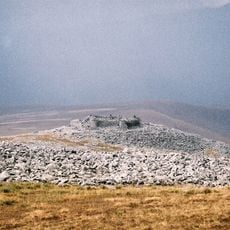
Abuli fortress
15.8 km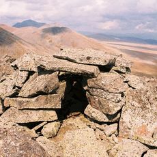
Shaori fortress
9.5 km
VAHAN TERYAN home museum
13.6 km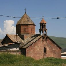
Սուրբ Կարապետ եկեղեցի (Գանձա)
13.4 km
Samsari Volcanic Center
16.3 km
Ღვთისმშობლის ეკლესია
15.1 km
Განძანის ციხე
13.9 km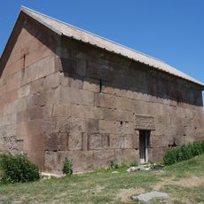
Paravani Church
736 m
Სალამალექის ქარვასლა
13.4 km
Ციკლოპური ციხე
15.1 km
Ფარავნის ქარვასლა
686 m
Ფარავნის ეკლესია
619 m
Საღამოს ეკლესია
16.6 km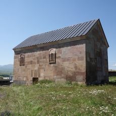
St. Nino Church, Poka
7 km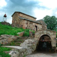
Აიაზმის ღვთისმშობლის ეკლესია
15.4 km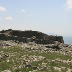
Abuli Fortress
15.8 km
Შაორის ციკლოპური ციხე
9.5 km
Nardevani cyclopean fortress
14.8 km
Chikiani menhire
6.2 km
Ეკლესია, მენჰირი და კრომლეხი
16.3 km
Განძანის ხიდი
13.3 km
Scenic viewpoint
14.6 km
Აბულის ციხე
15.8 km
Ნარდევანის ციკლოპური ციხე-ხევღრმა
15.1 km
Memorial
13.6 km
Memorial
5.7 km
Memorial, war memorial
5.6 km
Memorial
5.8 kmReviews
Visited this place? Tap the stars to rate it and share your experience / photos with the community! Try now! You can cancel it anytime.
Discover hidden gems everywhere you go!
From secret cafés to breathtaking viewpoints, skip the crowded tourist spots and find places that match your style. Our app makes it easy with voice search, smart filtering, route optimization, and insider tips from travelers worldwide. Download now for the complete mobile experience.

A unique approach to discovering new places❞
— Le Figaro
All the places worth exploring❞
— France Info
A tailor-made excursion in just a few clicks❞
— 20 Minutes