Grenzstein von 1529
Location: Obergladbach
Location: Schlangenbad
GPS coordinates: 50.07997,8.01212
Latest update: November 23, 2025 05:18
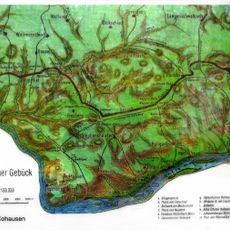
Rheingauer Gebück
344 m
Hof Mappen
1.4 km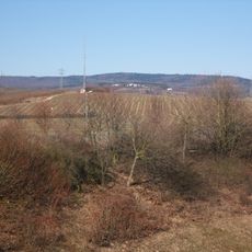
Erbacher Kopf
2.1 km
Gladbachtal bei Obergladbach
811 m
Gauls Kopf
2.2 km
Haus Rüdesheimer Straße 7Rüdesheimer Straße 9
2.3 km
Rabenkopf
1.6 km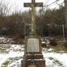
Friedhofskreuz
1.3 km
Ehemaliges Rathaus
2.3 km
Katholische Kapelle St. Nikolaus
1.1 km
Haus Nikolausstraße 8
1.1 km
Haus Rüdesheimer Straße 23
2.4 km
Haus Nikolausstraße 1
1 km
Haus Taunusstraße 2
2.3 km
Haus Nikolausstraße 3
1 km
Haus Alte Schmiede 4a
2.3 km
Haus Fischbacher Straße 4
2.3 km
Haus Nikolausstraße 15
1.1 km
Haus Bangertstraße 1
1 km
Haus Rüdesheimer Straße 4
2.3 km
Haus Tannenweg 2
1.4 km
Haus Gladbacher Straße 5
2.3 km
Mapper Schanze
1.7 km
Archaeological site
1.2 km
Jägerkreuz
924 m
Archaeological site
2.3 km
Archaeological site
2.2 km
Archaeological site
2.2 kmReviews
Visited this place? Tap the stars to rate it and share your experience / photos with the community! Try now! You can cancel it anytime.
Discover hidden gems everywhere you go!
From secret cafés to breathtaking viewpoints, skip the crowded tourist spots and find places that match your style. Our app makes it easy with voice search, smart filtering, route optimization, and insider tips from travelers worldwide. Download now for the complete mobile experience.

A unique approach to discovering new places❞
— Le Figaro
All the places worth exploring❞
— France Info
A tailor-made excursion in just a few clicks❞
— 20 Minutes