Lehrbienenstand Imkerverein
Location: Obermünstertal
Location: Münstertal
GPS coordinates: 47.87832,7.83630
Latest update: October 11, 2024 03:49
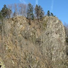
Burg Scharfenstein (Black Forest)
1.9 km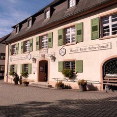
Bienenkundemuseum Münstertal
80 m
Preyerwaldfelsen
1.8 km
Scharfenstein und Rehfelsen
2 km
5 Weidbuchen
1 km
1 Sommerlinde am Bittersthof
2.1 km
1 Sommerlinde am Bittersthof
2.1 km
Felsen am Stampfbachweg
1.2 km
Scenic viewpoint
1.2 km
Wayside cross
175 m
Scenic viewpoint
1 km
Lusthäusle
1.1 km
Kneippanlage
825 m
Wayside shrine
731 m
Sonnhaldeeck
1.4 km
Sonnhaldeberg
1.6 km
Kohlerhof
1.6 km
Wayside cross
1.8 km
Wayside cross
294 m
Gstihlberg
924 m
Scharfenstein
1.9 km
Burg Scharfenstein
1.9 km
Wayside cross
1.9 km
Wayside cross
145 m
Christianity, wayside shrine
2 km
Breitacker
2.1 km
Wayside cross
2.1 km
Schwarzwälder Korbstand
91 mReviews
Visited this place? Tap the stars to rate it and share your experience / photos with the community! Try now! You can cancel it anytime.
Discover hidden gems everywhere you go!
From secret cafés to breathtaking viewpoints, skip the crowded tourist spots and find places that match your style. Our app makes it easy with voice search, smart filtering, route optimization, and insider tips from travelers worldwide. Download now for the complete mobile experience.

A unique approach to discovering new places❞
— Le Figaro
All the places worth exploring❞
— France Info
A tailor-made excursion in just a few clicks❞
— 20 Minutes