Lastahuddelhuppen
Location: Gillenfeld
Accessibility: Wheelchair accessible
Operator: Bürgergruppe "Die Anstifter" Gillenfeld
GPS coordinates: 50.12824,6.92759
Latest update: November 20, 2025 00:43
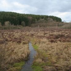
Strohner Maarchen
676 m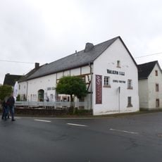
Vulkanhaus Strohn
2.1 km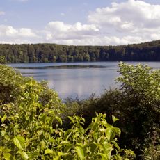
Pulvermaar mit Römerberg und Strohner Märchen
237 m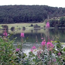
Immerather Maar
2.3 km
Römerberg
446 m
Strohmer Schweiz und Wartgesberg
2.4 km
Dorfblick
2.5 km
Wegekreuz "auf Hombüsch"
2 km
Lavabombe
2.3 km
Antonius
2.6 km
Scenic viewpoint
2.3 km
Scenic viewpoint
2.4 km
Scenic viewpoint
2.3 km
Ellscheider Maarblick
2.1 km
Ziegenkäserei mit Hofladen Vulkanhof
952 m
Wayside shrine, Christianity
2.3 km
Altes Pulverhäuschen
2.5 km
Parcours der Sinne
2.6 km
Archaeological site
2.7 km
Archaeological site
2.7 km
Archaeological site
2.7 km
Archaeological site
2.7 km
Archaeological site
2.7 km
Archaeological site
2.7 km
Archaeological site
2.7 km
Archaeological site
2.7 km
Archaeological site
2.7 km
Archaeological site
2.7 kmReviews
Visited this place? Tap the stars to rate it and share your experience / photos with the community! Try now! You can cancel it anytime.
Discover hidden gems everywhere you go!
From secret cafés to breathtaking viewpoints, skip the crowded tourist spots and find places that match your style. Our app makes it easy with voice search, smart filtering, route optimization, and insider tips from travelers worldwide. Download now for the complete mobile experience.

A unique approach to discovering new places❞
— Le Figaro
All the places worth exploring❞
— France Info
A tailor-made excursion in just a few clicks❞
— 20 Minutes