Wassertretanlage
Location: Tennenbronn
Location: Schramberg
Operator: Stadt Schramberg
GPS coordinates: 48.20001,8.35608
Latest update: November 23, 2025 08:30
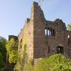
Burg Hohenschramberg
3.3 km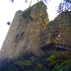
Ruine Falkenstein
2.3 km
Ruine Ramstein (Schramberg)
2.4 km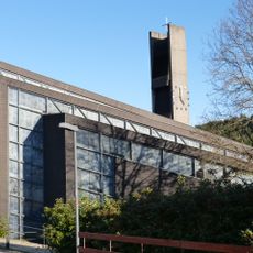
St. Johann Baptist
1.1 km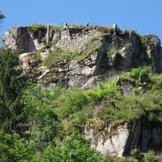
Ruine Berneck
2.1 km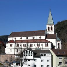
St. Michael
3.2 km
Evangelische Kirche Lauterbach
3.3 km
Oberes Schiltachtal, Bernecktal
2.2 km
Mittelberg
1.8 km
2 Linden bei der Falkensteinkapelle
2.6 km
Scenic viewpoint
2.2 km
Wayside shrine
1.4 km
Scenic viewpoint
2.5 km
Scenic viewpoint
2.3 km
Scenic viewpoint
2.8 km
Scenic viewpoint
2.4 km
Scenic viewpoint
2.5 km
Elisabethenfelsen
2.9 km
Kreuzfelsen
3.3 km
Scenic viewpoint
3.3 km
Wayside cross
2.8 km
Wayside cross
3 km
Wayside cross, Christianity
3.3 km
Catholic church building, wayside shrine, Christianity
3.2 km
Christianity, house of prayer, Catholic church building, place of worship, wayside shrine
2.6 km
Catholic church building, wayside cross, Christianity
2.6 km
Wayside cross
2.2 km
Lauterbach-Wasserfälle
2.8 kmReviews
Visited this place? Tap the stars to rate it and share your experience / photos with the community! Try now! You can cancel it anytime.
Discover hidden gems everywhere you go!
From secret cafés to breathtaking viewpoints, skip the crowded tourist spots and find places that match your style. Our app makes it easy with voice search, smart filtering, route optimization, and insider tips from travelers worldwide. Download now for the complete mobile experience.

A unique approach to discovering new places❞
— Le Figaro
All the places worth exploring❞
— France Info
A tailor-made excursion in just a few clicks❞
— 20 Minutes