Esel
Location: Mechernich
Operator: Hochwildpark Rheinland
GPS coordinates: 50.60609,6.67769
Latest update: November 20, 2025 06:48
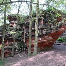
Katzensteine
758 m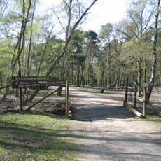
Hochwildpark Rheinland
93 m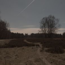
Schavener Heide
1.4 km
Burgvey
1.4 km
Veybach zwischen Breitenbenden und Satzvey
1.1 km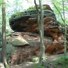
Katzensteine
820 m
Zülpicher Hau
664 m
Schavener Heide
1.3 km
Ziegen
18 m
Kaninchen
62 m
Alter Panzer
956 m
Alter Panzer
954 m
Oberirdische Schützengräben
1.2 km
Unterirdische Schützengräben
413 m
Ehmaliger röm. Steinbruch
905 m
Minischweine
36 m
Hühner & Enten
48 m
1000 jährige Eiche
1.1 km
Ungarisches Steppenrind
239 m
Kamerunschafe
326 m
Steinwild
702 m
Elche
558 m
Vögel
37 m
Schwarzwild
808 m
Christianity, Catholic church building, wayside cross
1.4 km
Wayside cross, Christianity
1.2 km
Aufschluss röm. Wasserleitung
1.4 km
Catholic church building, wayside cross, Christianity
730 mReviews
Visited this place? Tap the stars to rate it and share your experience / photos with the community! Try now! You can cancel it anytime.
Discover hidden gems everywhere you go!
From secret cafés to breathtaking viewpoints, skip the crowded tourist spots and find places that match your style. Our app makes it easy with voice search, smart filtering, route optimization, and insider tips from travelers worldwide. Download now for the complete mobile experience.

A unique approach to discovering new places❞
— Le Figaro
All the places worth exploring❞
— France Info
A tailor-made excursion in just a few clicks❞
— 20 Minutes