Steinwild
Location: Mechernich
Operator: Hochwildpark Rheinland
GPS coordinates: 50.61169,6.67314
Latest update: October 11, 2024 04:24
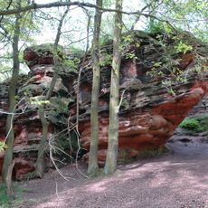
Katzensteine
1.4 km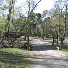
Hochwildpark Rheinland
717 m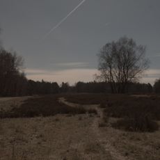
Schavener Heide
1.2 km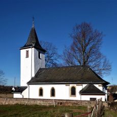
Agatha of Sicily Chapel (Schaven)
914 m
Veybach zwischen Breitenbenden und Satzvey
1.4 km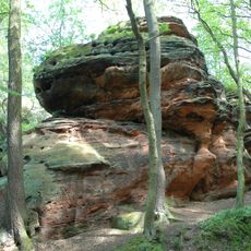
Katzensteine
1.4 km
Zülpicher Hau
203 m
Pütz-Berg
901 m
Schavener Heide
799 m
Minischweine
727 m
Ungarisches Steppenrind
467 m
Hühner & Enten
724 m
Kaninchen
725 m
Esel
702 m
Vögel
698 m
Alter Panzer
830 m
Alter Panzer
844 m
Oberirdische Schützengräben
662 m
Ziegen
702 m
Wayside cross, Christianity, Catholic church building
943 m
Catholic church building, wayside cross, Christianity
986 m
Holzkonstruktion
1 km
Kamerunschafe
376 m
Wayside cross, Christianity
1.3 km
Catholic church building, wayside cross, Christianity
1.4 km
Elche
364 m
Unterirdische Schützengräben
333 m
Catholic church building, wayside cross, Christianity
1.4 kmReviews
Visited this place? Tap the stars to rate it and share your experience / photos with the community! Try now! You can cancel it anytime.
Discover hidden gems everywhere you go!
From secret cafés to breathtaking viewpoints, skip the crowded tourist spots and find places that match your style. Our app makes it easy with voice search, smart filtering, route optimization, and insider tips from travelers worldwide. Download now for the complete mobile experience.

A unique approach to discovering new places❞
— Le Figaro
All the places worth exploring❞
— France Info
A tailor-made excursion in just a few clicks❞
— 20 Minutes