XXL-Bank
Location: Kottenheim
Operator: Verschönerungs- und Verkehrsverein e.V. Kottenheim
GPS coordinates: 50.35894,7.25370
Latest update: November 20, 2025 01:02
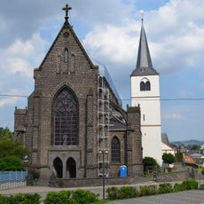
St. Cyriakus
2.1 km
Ettringer Bell-Berg
2.1 km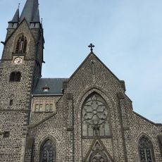
St. Nikolaus
1.2 km
Büden
1.4 km
Bellerberg volcano
2.1 km
Jüdischer Friedhof Niedermendig
2.1 km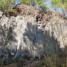
Kottenheimer Winfeld
1.1 km
Ettringer und Mayener Bellberg, Kottenheimer Bueden
1.9 km
Unterirdische stillgelegte Basaltgruben Mayen und Niedermendig
913 m
Nettetal
1.2 km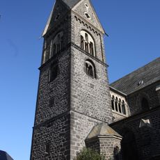
St. Johannes
1.5 km
Scenic viewpoint
2.1 km
100 Jahre K.K.G. 1913-14 e.V.
917 m
Work of art, relief sculpture
1.8 km
Steinhauerverein
1.7 km
Scenic viewpoint
1.3 km
Scenic viewpoint
1.7 km
Wayside cross
1.9 km
Sprengstoffbunker
1.8 km
Elefant
1.6 km
Work of art, sculpture
1.9 km
Freiwillige Feuerwehr Kottenheim Gegr. 1887
1.1 km
Catholic church building, wayside cross, Christianity
804 m
Wayside shrine, Christianity, Catholic church building
1.2 km
Catholic church building, wayside shrine, Christianity
1.2 km
Christianity, Catholic church building, wayside cross
1.1 km
Wayside cross
1.6 km
Minecart
867 mReviews
Visited this place? Tap the stars to rate it and share your experience / photos with the community! Try now! You can cancel it anytime.
Discover hidden gems everywhere you go!
From secret cafés to breathtaking viewpoints, skip the crowded tourist spots and find places that match your style. Our app makes it easy with voice search, smart filtering, route optimization, and insider tips from travelers worldwide. Download now for the complete mobile experience.

A unique approach to discovering new places❞
— Le Figaro
All the places worth exploring❞
— France Info
A tailor-made excursion in just a few clicks❞
— 20 Minutes