Vattensåg
Location: Skellefteå kommun
GPS coordinates: 64.75152,20.48348
Latest update: October 28, 2025 10:19
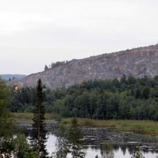
Björkdalsgruvan
20.9 km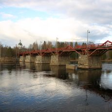
Lejonströmsbron
20.4 km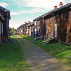
Bonnstan
21.2 km
Rismyrliden
9.2 km
Skellefteå tingslag
20.8 km
Femvägaskälet
6.8 km
Tingshuset i Skellefteå
21.5 km
Skellefteå Konsthall
21.6 km
Brännberget
17.9 km
Skellefteå socken 123
7.3 km
Skellefteå stad 18:2
16.6 km
Rijfska gården, Kusmark
20.1 km
Nybygget Rismyrliden
9.2 km
Skellefteå stad 45:3
17.5 km
Skellefteå stad 18:1
16.6 km
Skellefteå stad 344:1
21.1 km
Skellefteå stad 45:2
17.5 km
Majorsbostället Nyborg
21.6 km
Skellefteå socken 117
8 km
Skellefteå socken 118
7.2 km
Skellefteå stad 344:2
21.1 km
Skellefteå socken 178
18.8 km
Lilleputtlandet
19.3 km
Rismyrliden
9.2 km
Älgskeppet
21.5 km
Work of art
20.7 km
Scenic viewpoint
401 m
Scenic viewpoint
19.4 kmReviews
Visited this place? Tap the stars to rate it and share your experience / photos with the community! Try now! You can cancel it anytime.
Discover hidden gems everywhere you go!
From secret cafés to breathtaking viewpoints, skip the crowded tourist spots and find places that match your style. Our app makes it easy with voice search, smart filtering, route optimization, and insider tips from travelers worldwide. Download now for the complete mobile experience.

A unique approach to discovering new places❞
— Le Figaro
All the places worth exploring❞
— France Info
A tailor-made excursion in just a few clicks❞
— 20 Minutes