The oldest tree
Location: Яремче
Location: Яремчанська міська громада
GPS coordinates: 48.44622,24.56264
Latest update: October 11, 2024 07:41
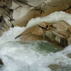
Probiy
1.8 km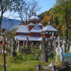
Yamna
1.1 km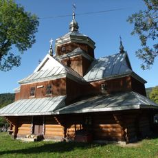
Saint John the Almoner church in Yaremche
1.8 km
Nativity of St. John the Baptist
687 m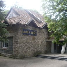
Yaremche museum ethnography and ecology
720 m
Точка огляду
1.2 km
Scenic viewpoint
1.4 km
Вид на Білу Скалу та річку Прут
601 m
Скелі Довбуша
714 m
Вид на скелю Слон
593 m
Guzul. Povorot na skelu Slon
760 m
Леся Українка
863 m
Вид на Яремче з Білого Слону
493 m
Rock Slon
468 m
Роксолана
1.3 km
Точка огляду над річкою Прут
1.3 km
Scenic viewpoint
645 m
Гуцульська гойдалка
1.4 km
Камень Довбуша
1.5 km
Маковицькі полонини
1.6 km
База відпочинку «Арніка»
1.8 km
Skala Slon
440 m
Hutsulschchyna
1.8 km
Вид на кабанів
1.8 km
View & Break Point
289 m
"Пробій" водоспад
1.9 km
Карпати в мініатюрі
1.9 km
Гедзьо Парк Легенд
1.9 kmReviews
Visited this place? Tap the stars to rate it and share your experience / photos with the community! Try now! You can cancel it anytime.
Discover hidden gems everywhere you go!
From secret cafés to breathtaking viewpoints, skip the crowded tourist spots and find places that match your style. Our app makes it easy with voice search, smart filtering, route optimization, and insider tips from travelers worldwide. Download now for the complete mobile experience.

A unique approach to discovering new places❞
— Le Figaro
All the places worth exploring❞
— France Info
A tailor-made excursion in just a few clicks❞
— 20 Minutes