Queenston-Lewiston Bridge
Location: Niagara-on-the-Lake
GPS coordinates: 43.15308,-79.04561
Latest update: October 11, 2024 07:58
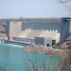
Robert Moses Niagara Power Plant
1.2 km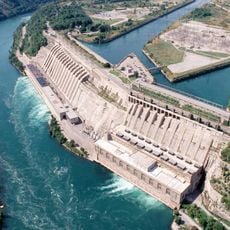
Sir Adam Beck Hydroelectric Generating Stations
626 m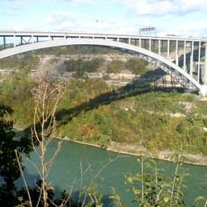
Lewiston–Queenston Bridge
94 m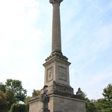
Brock's Monument
999 m
Earl W. Brydges Artpark State Park
1.2 km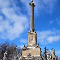
Queenston Heights
989 m
Fort Drummond
947 m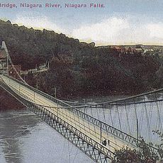
Lewiston–Queenston Suspension Bridge
976 m
Waterfall
980 m
Scenic viewpoint
1 km
Bower
904 m
Scenic viewpoint
657 m
Scenic viewpoint
631 m
Scenic viewpoint
498 m
Sir Isaac Brock monument
988 m
Scenic viewpoint
471 m
Floral Clock
427 m
Scenic viewpoint
1 km
Scenic viewpoint
1 km
Scenic viewpoint
712 m
Scenic viewpoint
1.1 km
Scenic viewpoint
1.1 km
Floral Clock and Lilac Grove
419 m
Artpark Outdoor Amphitheater
1.2 km
Scenic viewpoint
218 m
Niagara Falls Country Club
1.2 km
Riverbrink Art Museum
1.3 km
Scenic viewpoint
1.3 kmReviews
Visited this place? Tap the stars to rate it and share your experience / photos with the community! Try now! You can cancel it anytime.
Discover hidden gems everywhere you go!
From secret cafés to breathtaking viewpoints, skip the crowded tourist spots and find places that match your style. Our app makes it easy with voice search, smart filtering, route optimization, and insider tips from travelers worldwide. Download now for the complete mobile experience.

A unique approach to discovering new places❞
— Le Figaro
All the places worth exploring❞
— France Info
A tailor-made excursion in just a few clicks❞
— 20 Minutes