AMP269
Location: Rural Municipality of Mountain
GPS coordinates: 52.66749,-101.09820
Latest update: October 26, 2025 12:00
Duck Mountain Provincial Park
112.2 km
Fort Dauphin
138.4 km
Rhein
164.4 km
Doukhobors at Veregin
138.4 km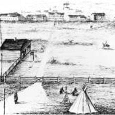
Fort Livingstone
103.8 km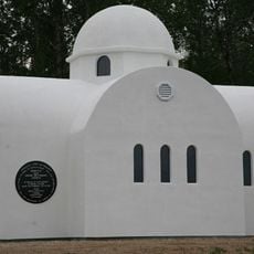
Profitis Ilias Greek Orthodox Church
114.2 km
Clearwater Lake Provincial Park
157.6 km
Sam Waller Museum
129.1 km
Little Limestone Lake Provincial Park
169.7 km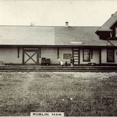
Roblin railway station
161 km
Rocky Lake Provincial Park
169 km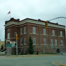
Court House and Community Building
129.1 km
AMP347
29.5 km
AMP190
34.7 km
AMP214
24.9 km
AMP114
68.8 km
AMP133
60.6 km
AMP378
40.4 km
Fly Yard 1
18.1 km
Jct10-60
75.9 km
AMP224
21.4 km
AMP224
21.1 km
Al Mazur Memorial Heritage Park
90.1 km
Swan
63.2 km
Statue, Work of art
89.4 km
Statue, Work of art
90 km
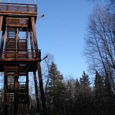
Tower, Observation tower, scenic viewpoint
135.8 km
Scenic viewpoint
35.3 kmReviews
Visited this place? Tap the stars to rate it and share your experience / photos with the community! Try now! You can cancel it anytime.
Discover hidden gems everywhere you go!
From secret cafés to breathtaking viewpoints, skip the crowded tourist spots and find places that match your style. Our app makes it easy with voice search, smart filtering, route optimization, and insider tips from travelers worldwide. Download now for the complete mobile experience.

A unique approach to discovering new places❞
— Le Figaro
All the places worth exploring❞
— France Info
A tailor-made excursion in just a few clicks❞
— 20 Minutes