Mesa Verde West Rim
Location: Montezuma County
GPS coordinates: 37.18749,-108.66732
Latest update: November 23, 2025 12:35
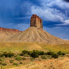
Chimney Rock
13 km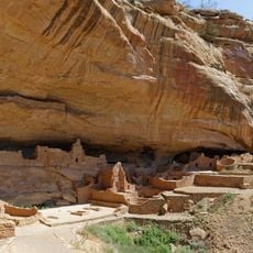
Long House
11.7 km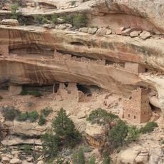
Kodak House
12.1 km
Badger House Community
12 km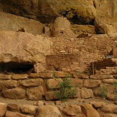
Step House
11.7 km
Pueblo Village
12 km
Basketmaker Pithouses
11.9 km
Badger House
12.1 km
Two Raven House
12.2 km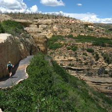
Step House Trail
11.7 km
Krueger Point
12.3 km
Rock Canyon Tower View
11.3 km
Mesa Verde West Rim
8 m
Pictograph Point
8.7 km
Long House Overlook
11.8 km
Kodak House Overlook
12.2 km
Long House (ticket required)
11.7 km
Pictograph Point
8.7 km
Krueger Point
12.3 km
Kodak House
12.1 km
Step House
11.7 km
Mug House
11.1 km
Jug House
11 km
Kodak House Overlook
12.2 km
Long House Overlook
11.8 km
Tower Overlook
11.3 km
Nordenskiold House Overlook
11.2 km
Scenic viewpoint
12.3 kmReviews
Visited this place? Tap the stars to rate it and share your experience / photos with the community! Try now! You can cancel it anytime.
Discover hidden gems everywhere you go!
From secret cafés to breathtaking viewpoints, skip the crowded tourist spots and find places that match your style. Our app makes it easy with voice search, smart filtering, route optimization, and insider tips from travelers worldwide. Download now for the complete mobile experience.

A unique approach to discovering new places❞
— Le Figaro
All the places worth exploring❞
— France Info
A tailor-made excursion in just a few clicks❞
— 20 Minutes