Enable Location

We need your location to show you interesting places around you

Discover nearby places

Find interesting locations and hidden gems around you

Precise directions

Get accurate directions and distances to places

Your location is never shared with other users. It's only used when you tap the location button.

Montezuma County

Log in to your account

Start exploring — it's free

Trusted by 62,179 travelers worldwide

Continue with Google
Continue with Apple
or

We will send you a code to connect

By continuing, you accept our Terms and Conditions and our Privacy Policy

Check your inbox

We've sent a pincode in your inbox. Please enter the code below.

Montezuma County, Administrative division in southwestern Colorado, United States.

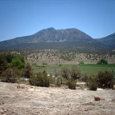
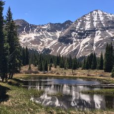
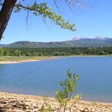
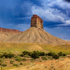
Montezuma County is an administrative division in southwestern Colorado with varied terrain spanning desert regions, mountains, and valleys. The San Juan Mountains form a prominent ridge that shapes the visual character of much of the landscape.

The county was established in 1889 after being carved from La Plata County. Its name comes from the Aztec emperor Montezuma II, given by early settlers who drew on broader historical references.

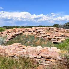
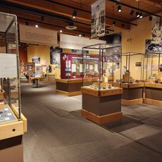
The Ute Mountain Ute Nation shapes daily life and cultural practices throughout the region, while archaeological sites scattered across the landscape display visible remains of ancient Puebloan communities.

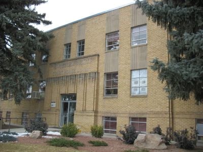
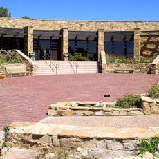
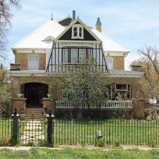
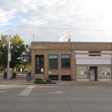
Cortez serves as the county seat with government offices at 109 West Main Street handling administration, health, and law enforcement services. The area's size means visitors should allow time for travel between different sections of the county.

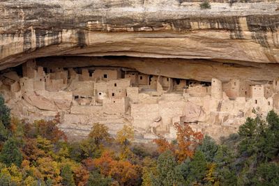
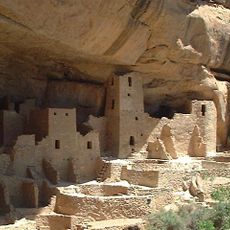
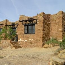
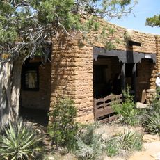
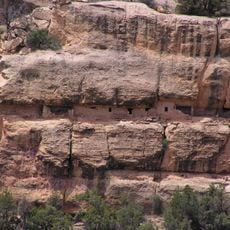
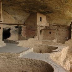
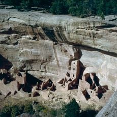
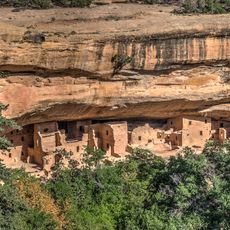
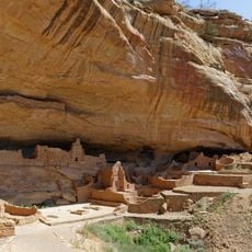
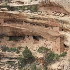
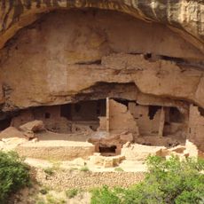
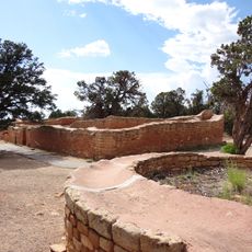
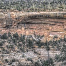
Mesa Verde National Park sits within the county and preserves cliff dwellings that show how ancient people built homes directly into rock faces. These structures reveal construction techniques and room layouts from centuries ago.

The community of curious travelers

AroundUs brings together thousands of curated places, local tips, and hidden gems, enriched daily by 60,000 contributors worldwide.

Start exploring
Location
Inception
April 1889
Capital city
Cortez
Shares border with
Dolores County, San Juan County, La Plata County, Apache County
GPS coordinates
37.34000,-108.60000
Latest update
December 20, 2025 15:43
Around this place
Mesa Verde National Park
United States of America

Mesa Verde National Park

16.6 km
Four Corners Monument
United States of America

Four Corners Monument

54.8 km
Ute Mountain
United States of America

Ute Mountain

17 km
Hesperus Mountain
United States of America

Hesperus Mountain

46.7 km
McPhee Reservoir
United States of America

McPhee Reservoir

26.6 km
Mancos State Park
United States of America

Mancos State Park

30 km
Lowry Pueblo
United States of America

Lowry Pueblo

39.2 km
Anasazi Heritage Center
United States of America

Anasazi Heritage Center

15.9 km
Chimney Rock
United States of America

Chimney Rock

31 km
Mesa Verde Administrative District
United States of America

Mesa Verde Administrative District

19.9 km
Chapin Mesa Archeological Museum
United States of America

Chapin Mesa Archeological Museum

19.9 km
Canyons of the Ancients Visitor Center and Museum
United States of America

Canyons of the Ancients Visitor Center and Museum

15.9 km
Wrightsman House
United States of America

Wrightsman House

27.4 km
House of Many Windows
United States of America

House of Many Windows

23 km
Balcony House
United States of America

Balcony House

23.2 km
Old Cortez High School
United States of America

Old Cortez High School

1.7 km
Montezuma Valley Irrigation Company Flume No. 6
United States of America

Montezuma Valley Irrigation Company Flume No. 6

8.6 km
Montezuma Valley National Bank and Store Building
United States of America

Montezuma Valley National Bank and Store Building

1.7 km
Mancos Theatre
United States of America

Mancos Theatre

27.5 km
Bauer Bank Block
United States of America

Bauer Bank Block

27.5 km
Mancos High School
United States of America

Mancos High School

27.2 km
Square Tower House
United States of America

Square Tower House

21.6 km
Spruce Tree House
United States of America

Spruce Tree House

20 km
Long House
United States of America

Long House

18 km
Kodak House
United States of America

Kodak House

19.1 km
Oak Tree House
United States of America

Oak Tree House

22.5 km
Sun Temple
United States of America

Sun Temple

22.4 km
Hemenway House
United States of America

Hemenway House

24 km
Show the full map
Administrative divisions
« Montezuma County - Administrative division in southwestern Colorado, United States » is provided by Around Us (aroundus.com). Images and texts are derived from Wikimedia project under a Creative Commons license. You are allowed to copy, distribute, and modify copies of this page, under the conditions set by the license, as long as this note is clearly visible.

Discover hidden gems everywhere you go!

From secret cafés to breathtaking viewpoints, skip the crowded tourist spots and find places that match your style. Our app makes it easy with voice search, smart filtering, route optimization, and insider tips from travelers worldwide. Download now for the complete mobile experience.

Around Us App Screenshot

A unique approach to discovering new places

Le Figaro

All the places worth exploring

France Info

A tailor-made excursion in just a few clicks

20 Minutes

Around Us
Travel Guide & Maps
Download

Send to your phone

QR Code
1

Open the camera app on your mobile.

2

Point at the QR code with your camera. A notification will appear.

3

Tap the notification to open the link.