Enable Location

We need your location to show you interesting places around you

Discover nearby places

Find interesting locations and hidden gems around you

Precise directions

Get accurate directions and distances to places

Your location is never shared with other users. It's only used when you tap the location button.

Lowry Pueblo

Log in to your account

Start exploring — it's free

Trusted by 61,663 travelers worldwide

Continue with Google
Continue with Apple
or

We will send you a code to connect

By continuing, you accept our Terms and Conditions and our Privacy Policy

Check your inbox

We've sent a pincode in your inbox. Please enter the code below.

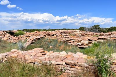
Lowry Pueblo, Archaeological site in Pleasant View, Colorado, United States.

Description

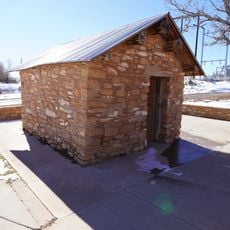
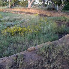
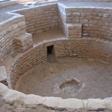
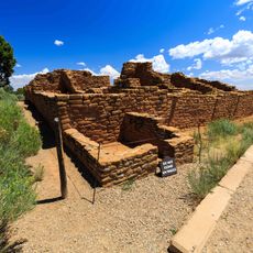
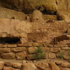
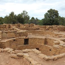
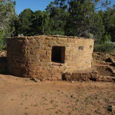
Lowry Pueblo is an ancestral Puebloan settlement with thirty-seven residential rooms, eight regular kivas, and one great kiva spanning about 50 feet (15 m) across. The structures are carefully arranged around the central kivas, displaying the construction skill of the ancient builders.

History

The settlement was founded around 1060 and was occupied for roughly 165 years. Groups of 40 to 100 people lived here before the site was eventually abandoned.

Culture

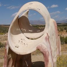
The great kiva served as a gathering space where the community came together for ceremonies and important decisions. White painted geometric patterns decorated the interior walls, showing the artistic skill of the people who lived there.

Practical

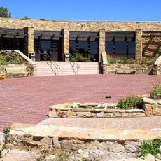
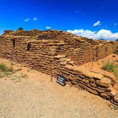
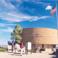
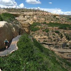
The site is reached by car and sits about 18 miles (29 km) north of Cortez after turning west on Road CC. Visitors should expect unpaved paths and check the weather before visiting.

Did you know?

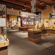
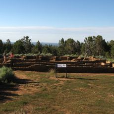
The Field Museum of Natural History in Chicago conducted the first excavations between 1930 and 1934, helping establish dating patterns for other sites in the region. This early work made the place a key piece for understanding ancestral Puebloan culture across the wider area.

Location
GPS coordinates
37.58453,-108.91965
Latest update
December 11, 2025 11:04

AroundUs brings together thousands of curated places, local tips, and hidden gems, enriched daily by 60,000 contributors worldwide. Discover all places nearby (Montezuma County).

Around this place
Mesa Verde National Park
United States of America

Mesa Verde National Park

55.7 km
Ute Mountain
United States of America

Ute Mountain

35.7 km
McPhee Reservoir
United States of America

McPhee Reservoir

30.7 km
Edge of the Cedars State Park Museum
United States of America

Edge of the Cedars State Park Museum

50.6 km
Anasazi Heritage Center
United States of America

Anasazi Heritage Center

35.1 km
Alkali Ridge
United States of America

Alkali Ridge

46.4 km
Swallow's Nest
United States of America

Swallow's Nest

48.9 km
Canyons of the Ancients Visitor Center and Museum
United States of America

Canyons of the Ancients Visitor Center and Museum

35.1 km
Old Cortez High School
United States of America

Old Cortez High School

39.8 km
Frederick Isaac and Mary M. Jones House
United States of America

Frederick Isaac and Mary M. Jones House

48.8 km
Montezuma Valley Irrigation Company Flume No. 6
United States of America

Montezuma Valley Irrigation Company Flume No. 6

45.3 km
Montezuma Valley National Bank and Store Building
United States of America

Montezuma Valley National Bank and Store Building

39.5 km
Far View Reservoir
United States of America

Far View Reservoir

53 km
Megalithic House
United States of America

Megalithic House

53 km
Knife Edge Trail
United States of America

Knife Edge Trail

53.1 km
Far View House
United States of America

Far View House

53.3 km
Step House
United States of America

Step House

54.9 km
Coyote Village
United States of America

Coyote Village

53.3 km
Far View Sites Complex
United States of America

Far View Sites Complex

53.1 km
Pipe Shrine House
United States of America

Pipe Shrine House

53.4 km
Far View Tower
United States of America

Far View Tower

53.2 km
Far View Visitor Center
United States of America

Far View Visitor Center

52.1 km
Park Point Lookout
United States of America

Park Point Lookout

52.8 km
Step House Trail
United States of America

Step House Trail

54.8 km
Mesa Verde Visitor and Research Center
United States of America

Mesa Verde Visitor and Research Center

53 km
Colorado Welcome Center at Cortez
United States of America

Colorado Welcome Center at Cortez

40.3 km
Montezuma Valley Overlook
United States of America

Montezuma Valley Overlook

53 km
Mesa Verde National Park Entrance Station
United States of America

Mesa Verde National Park Entrance Station

52.7 km
Show the full map
« Lowry Pueblo - Archaeological site in Pleasant View, Colorado, United States » is provided by Around Us (aroundus.com). Images and texts are derived from Wikimedia project under a Creative Commons license. You are allowed to copy, distribute, and modify copies of this page, under the conditions set by the license, as long as this note is clearly visible.

Discover hidden gems everywhere you go!

From secret cafés to breathtaking viewpoints, skip the crowded tourist spots and find places that match your style. Our app makes it easy with voice search, smart filtering, route optimization, and insider tips from travelers worldwide. Download now for the complete mobile experience.

Around Us App Screenshot

A unique approach to discovering new places

Le Figaro

All the places worth exploring

France Info

A tailor-made excursion in just a few clicks

20 Minutes

Around Us
Travel Guide & Maps
Download

Send to your phone

QR Code
1

Open the camera app on your mobile.

2

Point at the QR code with your camera. A notification will appear.

3

Tap the notification to open the link.