Enable Location

We need your location to show you interesting places around you

Discover nearby places

Find interesting locations and hidden gems around you

Precise directions

Get accurate directions and distances to places

Your location is never shared with other users. It's only used when you tap the location button.

McPhee Reservoir

Log in to your account

Start exploring — it's free

Trusted by 62,193 travelers worldwide

Continue with Google
Continue with Apple
or

We will send you a code to connect

By continuing, you accept our Terms and Conditions and our Privacy Policy

Check your inbox

We've sent a pincode in your inbox. Please enter the code below.

McPhee Reservoir

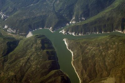
McPhee Reservoir, reservoir in Montezuma County, Colorado, United States

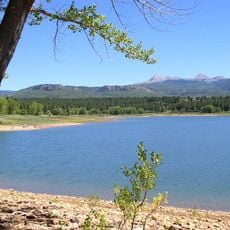
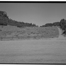
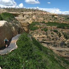
McPhee Reservoir is a large lake in the San Juan National Forest, roughly 10 miles south of Dolores in Montezuma County. It is surrounded by pinyon, juniper, and sagebrush landscapes and offers about 50 miles of shoreline to explore.

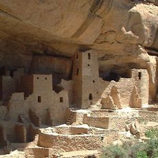
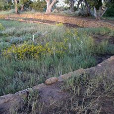
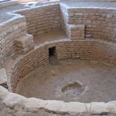
The reservoir was built in the 1980s and is now one of the largest water storage areas in southwestern Colorado. The region has a long history of settlement, with traces of the Ancestral Puebloans and later European logging operations, remembered by an old locomotive from 1947.

The reservoir takes its name from James McPhee, an early settler of the region. Today, visitors use this place for boating, fishing, and camping, showing how it has become a center for outdoor recreation and gathering.

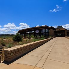
Visitors can launch vehicles and boats at several ramps that are easy to access during the season. It helps to arrive early to find parking, especially during the busy season from May through September.

An old piece of railroad history sits at the edge of the reservoir: a Montezuma Lumber Company locomotive from 1947 that recalls the era of logging. This unexpected monument tells the story of past industrial activity in the region.

The community of curious travelers

AroundUs brings together thousands of curated places, local tips, and hidden gems, enriched daily by 60,000 contributors worldwide.

Start exploring
Location
Elevation above the sea
2,112 m
GPS coordinates
37.57750,-108.57222
Latest update
February 7, 2026 11:01
Around this place
Mesa Verde National Park
United States of America

Mesa Verde National Park

37.7 km
Ute Mountain
United States of America

Ute Mountain

37.4 km
Mancos State Park
United States of America

Mancos State Park

33.2 km
Lowry Pueblo
United States of America

Lowry Pueblo

30.7 km
Anasazi Heritage Center
United States of America

Anasazi Heritage Center

11.5 km
Canyons of the Ancients Visitor Center and Museum
United States of America

Canyons of the Ancients Visitor Center and Museum

11.5 km
Wrightsman House
United States of America

Wrightsman House

35.9 km
Old Cortez High School
United States of America

Old Cortez High School

25.7 km
Montezuma Valley Irrigation Company Flume No. 6
United States of America

Montezuma Valley Irrigation Company Flume No. 6

26.3 km
Montezuma Valley National Bank and Store Building
United States of America

Montezuma Valley National Bank and Store Building

25.5 km
Mancos Theatre
United States of America

Mancos Theatre

36 km
Bauer Bank Block
United States of America

Bauer Bank Block

36 km
Mancos High School
United States of America

Mancos High School

35.8 km
Far View Reservoir
United States of America

Far View Reservoir

38 km
Megalithic House
United States of America

Megalithic House

37.8 km
Knife Edge Trail
United States of America

Knife Edge Trail

32.7 km
Far View House
United States of America

Far View House

38.3 km
Coyote Village
United States of America

Coyote Village

38.4 km
Far View Sites Complex
United States of America

Far View Sites Complex

38.3 km
Pipe Shrine House
United States of America

Pipe Shrine House

38.3 km
Far View Tower
United States of America

Far View Tower

38.2 km
Far View Visitor Center
United States of America

Far View Visitor Center

36.2 km
Park Point Lookout
United States of America

Park Point Lookout

34.5 km
Step House Trail
United States of America

Step House Trail

42.4 km
Mesa Verde Visitor and Research Center
United States of America

Mesa Verde Visitor and Research Center

30.6 km
Colorado Welcome Center at Cortez
United States of America

Colorado Welcome Center at Cortez

25.4 km
Montezuma Valley Overlook
United States of America

Montezuma Valley Overlook

33.3 km
Mesa Verde National Park Entrance Station
United States of America

Mesa Verde National Park Entrance Station

30.7 km
Show the full map
« McPhee Reservoir - reservoir in Montezuma County, Colorado, United States » is provided by Around Us (aroundus.com). Images and texts are derived from Wikimedia project under a Creative Commons license. You are allowed to copy, distribute, and modify copies of this page, under the conditions set by the license, as long as this note is clearly visible.

Discover hidden gems everywhere you go!

From secret cafés to breathtaking viewpoints, skip the crowded tourist spots and find places that match your style. Our app makes it easy with voice search, smart filtering, route optimization, and insider tips from travelers worldwide. Download now for the complete mobile experience.

Around Us App Screenshot

A unique approach to discovering new places

Le Figaro

All the places worth exploring

France Info

A tailor-made excursion in just a few clicks

20 Minutes

Around Us
Travel Guide & Maps
Download

Send to your phone

QR Code
1

Open the camera app on your mobile.

2

Point at the QR code with your camera. A notification will appear.

3

Tap the notification to open the link.