Four Corners Monument, Boundary marker at state borders of Arizona, Colorado, New Mexico, and Utah, United States.
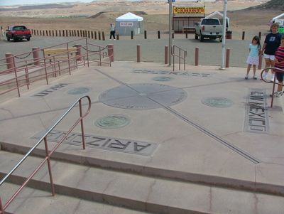
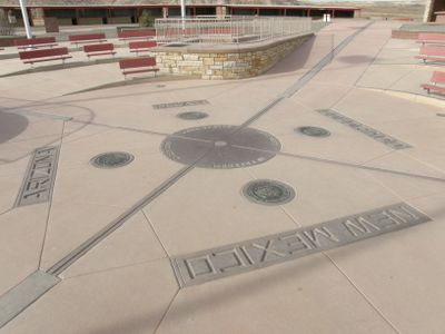
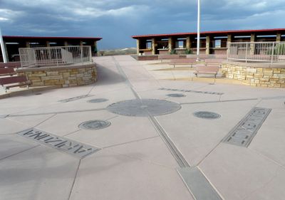
Four Corners Monument is a boundary marker at the state borders of Arizona, Colorado, New Mexico, and Utah in the United States. A flat granite platform holds an embedded bronze disk, and each of the four states is represented by its seal in the surrounding slabs.
Early surveyors marked the point in 1868 when the western territories received their final boundaries. The current platform was installed in 1992 and replaces earlier simpler markers that had weathered over the decades.
The site is managed by the Navajo Nation, and local artisans offer handmade silver jewelry, pottery, and woven textiles. Visitors can speak directly with vendors and learn about the patterns and symbols in their work.
The site sits away from main highways in a dry highland region, so visitors should bring plenty of water and sun protection. The access road is unpaved and can become difficult to navigate after rain, especially during summer thunderstorm season.
Many visitors attempt to stand in all four states at once by spreading their arms and legs across the respective quadrants. The bronze disk shows fine lines that trace the exact course of the borders and mark the intersection at the center.
Location: Apache County
Location: Montezuma County
Location: San Juan County
Part of: political border
GPS coordinates: 36.99898,-109.04518
Latest update: December 14, 2025 23:43
Texas combines landscapes that barely resemble each other. The west spreads out in deserts and sand dunes, while the east is marked by swamps and dense forests. Between these extremes lie limestone cliffs, natural springs, and waterfalls that bubble up from the ground. The size of the state allows...
Shiprock
39.4 km
Ute Mountain
39.6 kmCowboy Wash
26.8 km
Chimney Rock
30.3 km
San Juan River Bridge at Shiprock
39.7 kmShiprock Historical Marker
39.6 kmGoodman Point
48.1 kmMesa Verde West Rim
39.6 kmBig Point
46.7 kmBlack Rock Point
24.5 kmTurners Bluff
47.4 kmBoundary Butte Viewpoint
45.2 kmWaterfall
43.5 kmW
38.1 kmMesa Verde West Rim
39.6 kmCanyon Overlook
42.9 kmTower Point
43 kmWaterfall
36.7 kmWaterfall
43.2 kmWaterfall
43.2 kmRoyal Arch
47 kmWaterfall
45.4 kmWaterfall
45.7 kmWaterfall
39.1 kmWaterfall
42.1 kmWaterfall
47.1 kmWaterfall
47.7 kmLower Twin Falls
16.3 kmVisited this place? Tap the stars to rate it and share your experience / photos with the community! Try now! You can cancel it anytime.
Discover hidden gems everywhere you go!
From secret cafés to breathtaking viewpoints, skip the crowded tourist spots and find places that match your style. Our app makes it easy with voice search, smart filtering, route optimization, and insider tips from travelers worldwide. Download now for the complete mobile experience.
A unique approach to discovering new places❞
— Le Figaro
All the places worth exploring❞
— France Info
A tailor-made excursion in just a few clicks❞
— 20 Minutes