Enable Location

We need your location to show you interesting places around you

Discover nearby places

Find interesting locations and hidden gems around you

Precise directions

Get accurate directions and distances to places

Your location is never shared with other users. It's only used when you tap the location button.

Hesperus Mountain

Log in to your account

Start exploring — it's free

Trusted by 62,535 travelers worldwide

Continue with Google
Continue with Apple
or

We will send you a code to connect

By continuing, you accept our Terms and Conditions and our Privacy Policy

Check your inbox

We've sent a pincode in your inbox. Please enter the code below.

Hesperus Mountain

Hesperus Mountain, Sacred mountain peak in Montezuma County, United States.

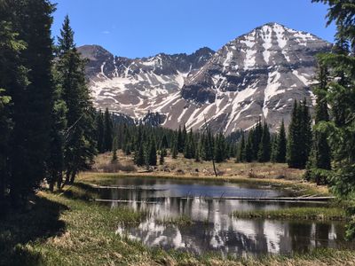
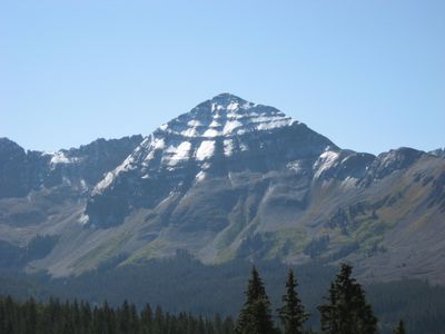
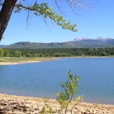
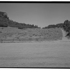
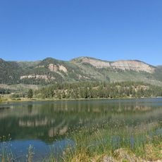
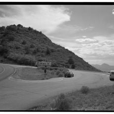
Hesperus Mountain is a prominent peak in the La Plata Mountains, rising to approximately 13,200 feet (4,000 meters) and dominating the landscape of northwestern Colorado. The summit offers expansive views across the surrounding ridges, valleys, and the high desert terrain that characterizes this region.

The peak forms the northern boundary of Dinetah, the ancestral lands of the Navajo people. This geographic marker has held significance for generations as communities navigated and lived within this mountainous terrain.

The mountain holds deep meaning in Navajo tradition as the Sacred Mountain of the North, a place woven into stories and spiritual beliefs. Local communities recognize it as a landmark that anchors their connection to this high desert landscape.

Reaching the summit requires climbing experience and scrambling skills, especially on exposed rock sections near the top. Late spring through early fall offers the most stable weather for attempting the peak.

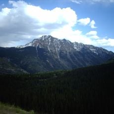
The mountain rises dramatically, standing more than 7,000 feet (2,100 meters) above the surrounding landscape. This striking elevation difference makes it visible as a reference point from vast distances across the region.

The community of curious travelers

AroundUs brings together thousands of curated places, local tips, and hidden gems, enriched daily by 60,000 contributors worldwide.

Start exploring
Location
GPS coordinates
37.44500,-108.08896
Latest update
December 10, 2025 15:50
Around this place
Mesa Verde National Park
United States of America

Mesa Verde National Park

38.2 km
Durango and Silverton Narrow Gauge Railroad
United States of America

Durango and Silverton Narrow Gauge Railroad

25.4 km
Mancos State Park
United States of America

Mancos State Park

16.8 km
Strater Hotel
United States of America

Strater Hotel

26.7 km
Twilight Peak
United States of America

Twilight Peak

40.1 km
Coal Bank Pass
United States of America

Coal Bank Pass

39.6 km
Anasazi Heritage Center
United States of America

Anasazi Heritage Center

40.5 km
Lemon Dam
United States of America

Lemon Dam

38.6 km
Main Avenue Historic District
United States of America

Main Avenue Historic District

26.6 km
Cascade Boy Scout Camp
United States of America

Cascade Boy Scout Camp

34.8 km
Durango High School
United States of America

Durango High School

26.4 km
Durango Discovery Museum
United States of America

Durango Discovery Museum

26.2 km
William Kauffman House
United States of America

William Kauffman House

28.1 km
Canyons of the Ancients Visitor Center and Museum
United States of America

Canyons of the Ancients Visitor Center and Museum

40.5 km
Wrightsman House
United States of America

Wrightsman House

20.9 km
Rico Town Hall
United States of America

Rico Town Hall

28 km
Montezuma Valley Irrigation Company Flume No. 6
United States of America

Montezuma Valley Irrigation Company Flume No. 6

38.2 km
Mancos Theatre
United States of America

Mancos Theatre

20.9 km
Bauer Bank Block
United States of America

Bauer Bank Block

20.9 km
Mancos High School
United States of America

Mancos High School

21.1 km
Knife Edge Trail
United States of America

Knife Edge Trail

34 km
Far View Visitor Center
United States of America

Far View Visitor Center

41.8 km
Haviland Lake
United States of America

Haviland Lake

26.6 km
Park Point Lookout
United States of America

Park Point Lookout

37.7 km
Hillcrest Golf Club
United States of America

Hillcrest Golf Club

27 km
Mesa Verde Visitor and Research Center
United States of America

Mesa Verde Visitor and Research Center

30.7 km
Lemon Reservoir
United States of America

Lemon Reservoir

38 km
Montezuma Valley Overlook
United States of America

Montezuma Valley Overlook

35.3 km
Show the full map
« Hesperus Mountain - Sacred mountain peak in Montezuma County, United States » is provided by Around Us (aroundus.com). Images and texts are derived from Wikimedia project under a Creative Commons license. You are allowed to copy, distribute, and modify copies of this page, under the conditions set by the license, as long as this note is clearly visible.

Discover hidden gems everywhere you go!

From secret cafés to breathtaking viewpoints, skip the crowded tourist spots and find places that match your style. Our app makes it easy with voice search, smart filtering, route optimization, and insider tips from travelers worldwide. Download now for the complete mobile experience.

Around Us App Screenshot

A unique approach to discovering new places

Le Figaro

All the places worth exploring

France Info

A tailor-made excursion in just a few clicks

20 Minutes

Around Us
Travel Guide & Maps
Download

Send to your phone

QR Code
1

Open the camera app on your mobile.

2

Point at the QR code with your camera. A notification will appear.

3

Tap the notification to open the link.