Durango High School, high school in Durango, La Plata County, Colorado, United States
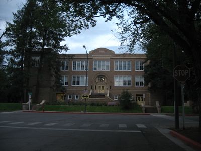
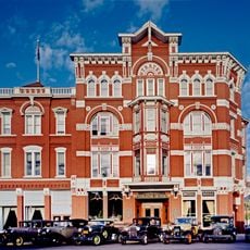
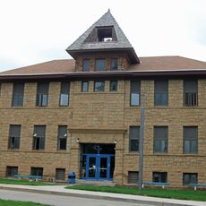
Durango High School is a historic school building in Durango, Colorado, constructed in 1917 and now serving as the school district's administrative offices. The structure features Classical Revival architecture with brick exterior, terra cotta decorative elements, tall windows, and a distinctive inverted-T floor plan that includes the original gymnasium and auditorium.
Durango's first high school opened in 1893, but rapid growth led to construction of this building, completed in 1917 by architects Thomas MacLaren and Charles Thomas. The community voted to approve the project and funded it through a municipal bond, with about 300 students enrolling when it opened that fall.
The school building carries deep meaning for the community as a gathering place that has connected generations. It reflects the town's values through its maintained grounds, artwork on its walls, and the events held within its spaces throughout the year.
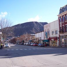
The building is located near downtown Durango on Main Avenue and is easily accessible on foot from the town center. As the school district's administrative office, you can view it from outside, though interior access may be limited to official business.
During World War I, the school stopped teaching German and burned German books in support of the war effort. In 1918, it closed for several weeks due to the Spanish flu pandemic, showing how local institutions faced major crises.
The community of curious travelers
AroundUs brings together thousands of curated places, local tips, and hidden gems, enriched daily by 60,000 contributors worldwide.