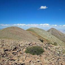
Little Egypt
Location: Garfield County
GPS coordinates: 38.07785,-110.62943
Latest update: October 12, 2024 08:11
Mount Ellen
16.5 km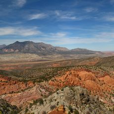
Mount Hillers
22 km
Penitentiary Point
22.2 km
Ragged Mountain
13.1 km
Mount Ellen Peak
16.9 km
Black Jump
15.4 km
Sandslide Point
15.7 km
Goatwater Point
9.8 km
Difficult To Pass Even with 4x4
10.5 km
Waterfall
18.4 km
Waterfall
13.9 km
Waterfall
9.7 km
Waterfall
16.5 km
Waterfall
9.3 km
Waterfall
9.1 km
Waterfall
16.9 km
Waterfall
17.2 km
Burr Point Overlook
18 km
Waterfall
18.2 km
Waterfall
14.4 km
Dirty Devil Crossing Overlook
18.7 km
Black Jump Overlook
19.2 km
Dirty Devil Overlook
19.3 km
Dirty Devil Overlook
19.9 km
Oil Well Point
20.9 km
Mesa Towers Overlook
20.9 km
Waterfall
8.6 km
Arsentic Arch
8.5 kmReviews
Visited this place? Tap the stars to rate it and share your experience / photos with the community! Try now! You can cancel it anytime.
Discover hidden gems everywhere you go!
From secret cafés to breathtaking viewpoints, skip the crowded tourist spots and find places that match your style. Our app makes it easy with voice search, smart filtering, route optimization, and insider tips from travelers worldwide. Download now for the complete mobile experience.

A unique approach to discovering new places❞
— Le Figaro
All the places worth exploring❞
— France Info
A tailor-made excursion in just a few clicks❞
— 20 Minutes