Arch
Location: San Juan County
GPS coordinates: 37.61625,-109.37179
Latest update: October 12, 2024 08:13

Recapture Canyon
6 km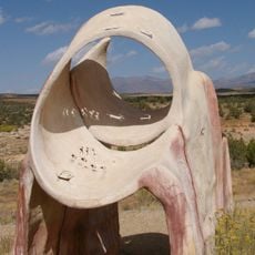
Edge of the Cedars State Park Museum
10.6 km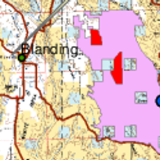
Alkali Ridge
13.2 km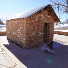
Swallow's Nest
8.9 km
Red Bluffs
25 km
Horsehead Point
20.2 km
Dodge Point
16.6 km
West Boulder Point
25.2 km
Ruin Spring Point
18.7 km
Montezuma Canyon
15.3 km
Scenic viewpoint
15 km
Scenic viewpoint
8.1 km
Three Kiva Pueblo
12 km
Waterfall
11.2 km
Waterfall
11.2 km
Waterfall
16.1 km
Solar Sculpture
10.7 km
Scenic viewpoint
10.6 km
Waterfall
19.1 km
Painted Rock
12.8 km
Waterfall
22.1 km
Scenic viewpoint
23.1 km
Waterfall
24.5 km
Waterfall
4.7 km
Waterfall
25 km
Waterfall
25.2 km
Waterfall
4.1 km
Butler Wash Ruins
25.3 kmReviews
Visited this place? Tap the stars to rate it and share your experience / photos with the community! Try now! You can cancel it anytime.
Discover hidden gems everywhere you go!
From secret cafés to breathtaking viewpoints, skip the crowded tourist spots and find places that match your style. Our app makes it easy with voice search, smart filtering, route optimization, and insider tips from travelers worldwide. Download now for the complete mobile experience.

A unique approach to discovering new places❞
— Le Figaro
All the places worth exploring❞
— France Info
A tailor-made excursion in just a few clicks❞
— 20 Minutes