Moab trail alt
Location: Montrose County
GPS coordinates: 38.43809,-109.04586
Latest update: October 12, 2024 08:17
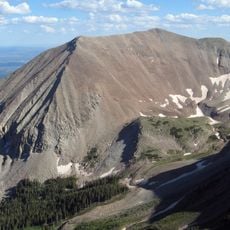
Mount Peale
16 km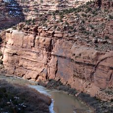
Hanging Flume
21.9 km
Dolores River Bridge
20.3 km
Pace Lake
13.6 km
Buckeye Reservoir
469 m
Waterfall
16.9 km
Waterfall
18 km
Waterfall
14.3 km
Waterfall
14.4 km
Waterfall
14.7 km
Waterfall
14.8 km
Waterfall
15.7 km
Waterfall
13.5 km
Waterfall
13.3 km
Waterfall
17 km
Waterfall
17.6 km
Waterfall
13.8 km
Waterfall
18.8 km
Waterfall
19.4 km
Waterfall
19.4 km
Moab trail
19.4 km
Waterfall
13.3 km
Waterfall
20.8 km
Hanging Flume Viewpoint
21.1 km
Waterfall
21.6 km
Moab trail alt
239 m
Waterfall
22.7 km
Waterfall
23.3 kmReviews
Visited this place? Tap the stars to rate it and share your experience / photos with the community! Try now! You can cancel it anytime.
Discover hidden gems everywhere you go!
From secret cafés to breathtaking viewpoints, skip the crowded tourist spots and find places that match your style. Our app makes it easy with voice search, smart filtering, route optimization, and insider tips from travelers worldwide. Download now for the complete mobile experience.

A unique approach to discovering new places❞
— Le Figaro
All the places worth exploring❞
— France Info
A tailor-made excursion in just a few clicks❞
— 20 Minutes