Montrose County

Log in to your account

AroundUs is a community-driven map of interesting places, built by curious explorers like you. It grows with every review, story, and photo you share.
Connect to save your favorite spots, contribute locations, and create personalized routes.
Continue with Google
Continue with Apple
Continue with X
Continue with Facebook
Continue with email
By continuing, you accept our Terms and Conditions and our Privacy Policy
Create an account
Add to collection
Map
Suggest a change
Share

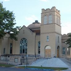
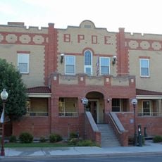
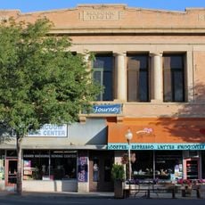
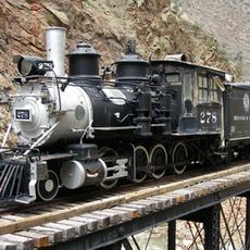
Montrose County, Administrative county in western Colorado, United States.

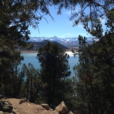
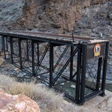
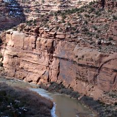
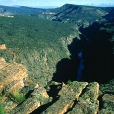
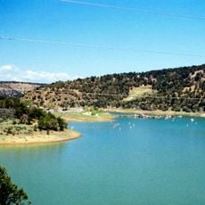
Montrose County is an administrative division in western Colorado that spans large stretches of land and encompasses important protected areas. Its territory includes sections of Black Canyon National Park and Uncompahgre National Forest.

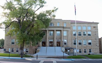
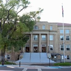
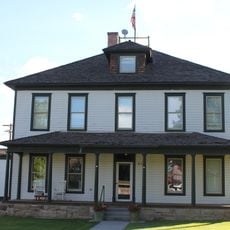
The county was established as an administrative unit in 1883, with the city of Montrose designated as its governmental center. This founding was part of the broader expansion and organization of Colorado's western regions during the late 1800s.

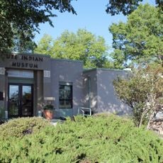
The Ute Indian Museum within the county preserves Native American artifacts and traditional items that tell the story of the Ute Nation's presence in the region. Visitors can explore how indigenous people lived and worked across these western lands through displays of crafts and daily objects.

Montrose Regional Airport serves as the main transportation hub for reaching the region. Visitors flying in can arrange onward travel to explore different areas of the county and beyond.

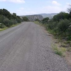
The county is home to sections of the Rimrocker Trail system, which winds through the western landscape connecting Colorado to Utah's border. This route offers access to remote terrain that many visitors overlook when exploring the area.

Location: Colorado

Inception: 1883

Capital city: Montrose

Shares border with: Mesa County, San Miguel County, Ouray County, San Juan County, Grand County, Delta County, Gunnison County

Website: http://montrosecounty.net

GPS coordinates: 38.41000,-108.27000

Latest update: December 7, 2025 19:23

Photos
Around this place
Ridgway State Park
United States of America

Ridgway State Park

51.7 km
Gunnison Tunnel
United States of America

Gunnison Tunnel

48.7 km
Morrow Point Dam
United States of America

Morrow Point Dam

64 km
D & RG Narrow Gauge Trestle
United States of America

D & RG Narrow Gauge Trestle

63 km
Hanging Flume
United States of America

Hanging Flume

46.1 km
Crystal Dam
United States of America

Crystal Dam

57.3 km
Morrow Point Reservoir
United States of America

Morrow Point Reservoir

64.1 km
Gunnison Gorge Wilderness
United States of America

Gunnison Gorge Wilderness

48.5 km
Ridgway Reservoir
United States of America

Ridgway Reservoir

49.1 km
Crystal Reservoir
United States of America

Crystal Reservoir

60.6 km
Ute Indian Museum
United States of America

Ute Indian Museum

35.2 km
Dolores River Bridge
United States of America

Dolores River Bridge

54.6 km
Methodist Episcopal Church of Montrose
United States of America

Methodist Episcopal Church of Montrose

35.5 km
North Rim Road, Black Canyon of the Gunnison National Park
United States of America

North Rim Road, Black Canyon of the Gunnison National Park

53.6 km
Montrose County Historical Museum
United States of America

Montrose County Historical Museum

34.8 km
Thomas B. Townsend House
United States of America

Thomas B. Townsend House

35.3 km
Benevolent and Protective Order of Elks Lodge
United States of America

Benevolent and Protective Order of Elks Lodge

35.3 km
Montrose Masonic Temple, Lodge No. 63
United States of America

Montrose Masonic Temple, Lodge No. 63

35.3 km
Rio Grande Southern Railroad Derrick Car
United States of America

Rio Grande Southern Railroad Derrick Car

62.5 km
Montrose County Courthouse
United States of America

Montrose County Courthouse

35.2 km
U.S. Bureau of Reclamation Project Office Building
United States of America

U.S. Bureau of Reclamation Project Office Building

35.1 km
North Rim Road
United States of America

North Rim Road

54.3 km
Painted Wall
United States of America

Painted Wall

50.9 km
Denver & Rio Grande Western Railroad 278
United States of America

Denver & Rio Grande Western Railroad 278

63 km
Denver & Rio Grande Western Railroad Caboose No. 0577
United States of America

Denver & Rio Grande Western Railroad Caboose No. 0577

63 km
Denver & Rio Grande Western Railroad Stock Car No. 5620
United States of America

Denver & Rio Grande Western Railroad Stock Car No. 5620

62.4 km
Denver & Rio Grande Western Railroad Boxcar No. 3132
United States of America

Denver & Rio Grande Western Railroad Boxcar No. 3132

63 km
Denver & Rio Grande Railroad Box Outfit Car No. 04414
United States of America

Denver & Rio Grande Railroad Box Outfit Car No. 04414

62.4 km
Show the full map
Reviews

Visited this place? Tap the stars to rate it and share your experience / photos with the community! Try now! You can cancel it anytime.

« Montrose County - Administrative county in western Colorado, United States » is provided by Around Us (aroundus.com). Images and texts are derived from Wikimedia project under a Creative Commons license. You are allowed to copy, distribute, and modify copies of this page, under the conditions set by the license, as long as this note is clearly visible.

Discover hidden gems everywhere you go!

From secret cafés to breathtaking viewpoints, skip the crowded tourist spots and find places that match your style. Our app makes it easy with voice search, smart filtering, route optimization, and insider tips from travelers worldwide. Download now for the complete mobile experience.

Around Us App Screenshot

A unique approach to discovering new places

Le Figaro

All the places worth exploring

France Info

A tailor-made excursion in just a few clicks

20 Minutes