
Crossing to: uphill - free entrance, downhill - road, left - parc entrance, right - another path
Crossing to: uphill - free entrance, downhill - road, left - parc entrance, right - another path
Location: Municipio de Santa Ana
GPS coordinates: 13.83711,-89.62540
Latest update: November 3, 2025 00:52
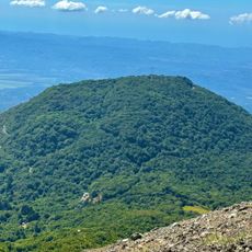
Cerro Verde
1.2 km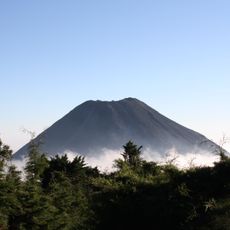
Izalco
2.7 km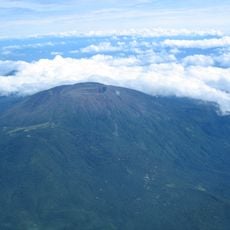
Santa Ana Volcano
1.6 km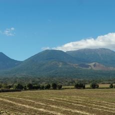
Los Volcanes National Park
1.1 km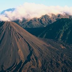
Los Volcanes Sector Los Andes National Park
3.6 km
Hedge art
1.1 km
Mirador al Volcan de Izalco
1.1 km
Intersection free trail - park trail - don’t go at 10:20-10:30
211 m
Volcano Santa Ana - park entrance
156 m
Ruta Volcan Izalco
1.4 km
Flower garden with covered walkways
1.2 km
Stairway covered by a carved hedge
1.1 km
Station Sysmique
401 m
Salvador del Mundo
6.7 km
Real trail goes here to entrance
453 m
Hedge art
1.2 km
Free entrance to Volcan Santa Ana
306 m
Mirador Volcán de Izalco
1.4 km
Mirador
1.1 km
Scenic viewpoint
954 m
Mirador
9.1 km
Scenic viewpoint
858 m
Scenic viewpoint
624 m
View of volcan izalco
1.2 km
Scenic viewpoint
2.5 km
Scenic viewpoint
4.2 km
Scenic viewpoint
6.6 km
Scenic viewpoint
9.1 kmReviews
Visited this place? Tap the stars to rate it and share your experience / photos with the community! Try now! You can cancel it anytime.
Discover hidden gems everywhere you go!
From secret cafés to breathtaking viewpoints, skip the crowded tourist spots and find places that match your style. Our app makes it easy with voice search, smart filtering, route optimization, and insider tips from travelers worldwide. Download now for the complete mobile experience.

A unique approach to discovering new places❞
— Le Figaro
All the places worth exploring❞
— France Info
A tailor-made excursion in just a few clicks❞
— 20 Minutes