Chest opened
+${chestReward.xp} XP
Explorer
NOUVEAU ×${chestReward.collectible.quantity}
tapez pour fermer

See the monuments around you in AR Open chests in the app

Around Us is built for your phone — point your camera at the streets and discover the monuments and places around you in augmented reality. Around Us is built for your phone — chests unlock when you walk, explore and capture nearby places.

•

Enable Location

We need your location to show you interesting places around you

Discover nearby places

Find interesting locations and hidden gems around you

Precise directions

Get accurate directions and distances to places

Your location is never shared with other users. It's only used when you tap the location button.

Izalco

Log in to your account

Start exploring — it's free

Trusted by 94,407 travelers worldwide

Continue with Google
Continue with Apple
or

We will send you a code to connect

By continuing, you accept our Terms and Conditions and our Privacy Policy

Check your inbox

We've sent a pincode in your inbox. Please enter the code below.

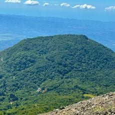
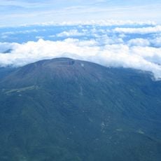
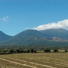
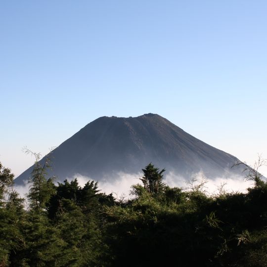
Izalco, Active stratovolcano in western El Salvador

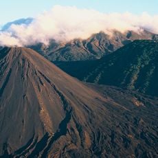
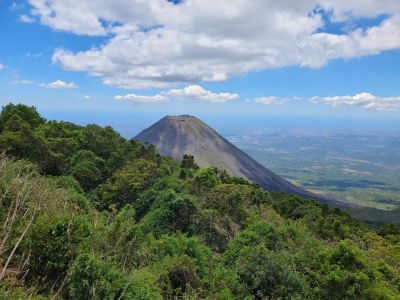
Izalco is a stratovolcano in Sonsonate Department in western El Salvador, rising to 1,950 meters above sea level. The cone shows a symmetrical shape with dark slopes of solidified lava and ash that stand out clearly against the green surroundings.

Fumarolic activity was recorded in 1658, and the cone was born in 1770 on the flank of the Santa Ana volcano. About 51 eruptions were registered between 1770 and 1956, and activity continued until 1958, with a small flank eruption in 1966. Its glow earned it the name "Lighthouse of the Pacific"; an 1926 eruption buried the village of Matazano and killed 56 people.

The name Izalco comes from Nahuatl Itshalco, "place in the obsidian sands", from itz-tl (obsidian), sha-lli (sand) and co (place). The cone appears on the 10 colón bank note, withdrawn when the US dollar replaced the colón in 2001, and its silhouette inspired the country's coat of arms.

Access is through Cerro Verde National Park, where marked hiking trails lead to the summit. The climb takes several hours and requires sturdy footwear, as the slopes consist of loose volcanic rock.

An eruption in 1926 buried the entire village of Matazano under ash and rock, killing 56 people. The remains of the settlement still lie hidden beneath the solidified volcanic material.

The community of curious travelers

AroundUs brings together thousands of curated places, local tips, and hidden gems, enriched daily by 94,407 contributors worldwide.
Start exploring
Elevation above the sea
1,952 m
Address
Izalco, El Salvador
GPS coordinates
13.81393,-89.63250
Latest update
October 25, 2026 05:58
Reviews
Share your experience

No review yet

Discussions
Start a discussion...

No discussion yet

« Izalco - Active stratovolcano in western El Salvador » is provided by Around Us (aroundus.com). Images and texts are derived from Wikimedia project under a Creative Commons license. You are allowed to copy, distribute, and modify copies of this page, under the conditions set by the license, as long as this note is clearly visible.

Discover hidden gems everywhere you go!

From secret cafés to breathtaking viewpoints, skip the crowded tourist spots and find places that match your style. Our app makes it easy with voice search, smart filtering, route optimization, and insider tips from travelers worldwide. Download now for the complete mobile experience.

Around Us App Screenshot
❝

A unique approach to discovering new places❞

— Le Figaro

❝

All the places worth exploring❞

— France Info

❝

A tailor-made excursion in just a few clicks❞

— 20 Minutes

Around Us
Travel Guide & Maps
Download

Send to your phone

QR Code
1

Open the camera app on your mobile.

2

Point at the QR code with your camera. A notification will appear.

3

Tap the notification to open the link.