El Imposible National Park
El Imposible National Park, National park in Ahuachapán Department, El Salvador
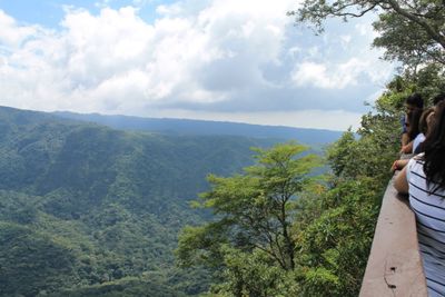
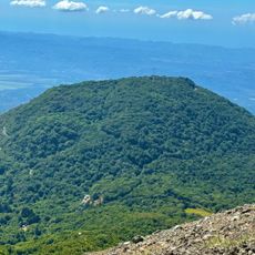
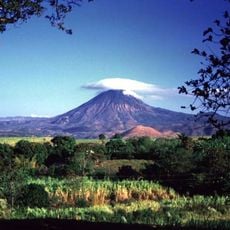
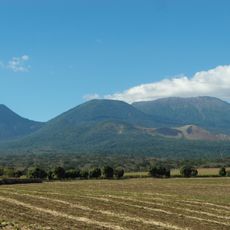
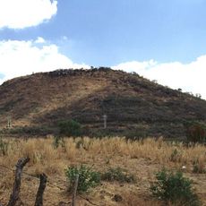
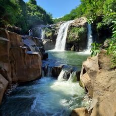
El Imposible National Park is a protected area situated between San Francisco Menéndez and Tacuba municipalities, covering mountainous terrain with elevations ranging from 250 to 1,425 meters (820 to 4,675 feet). The park features dense forests, steep hillsides, and multiple river systems that cut through the landscape.
The area was inhabited during pre-Hispanic times and later became a critical coffee trade route where travelers faced deadly risks crossing treacherous mountain passages. The park's name reflects the perilous nature of these historical journeys.
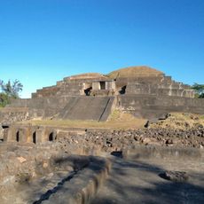
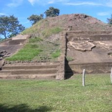
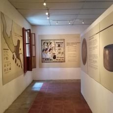
Eight archaeological sites within the park display pre-Hispanic artifacts, including Piedra Sellada with its stone engravings and petroglyphs along the Guayapa tributary.
Visiting requires permits from SALVANATURA offices, and you should prepare for varying weather conditions in the mountains. The dry season offers the best conditions for exploring, with easier trails and clearer views.
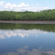
The park shelters several river sources that feed different ecosystems and is home to endangered white hawks found nowhere else in this region. These rare birds are a key part of the area's wildlife value.
Location: Ahuachapán Department
Inception: 1989
GPS coordinates: 13.84167,-89.95750
Latest update: December 6, 2025 16:04
El Salvador presents a collection of places where history, nature, and culture meet. The country is shaped by volcanic landscapes, clear lakes, and Pacific beaches that blend with archaeological sites from pre-Columbian times. Visitors can explore ancient Maya temples like Tazumal and Joya de Cerén,...
Tazumal
34.2 km
Cerro Verde
36.2 km
Izalco
35.3 km
Santa Ana Volcano
35.5 km
Santa Ana Cathedral, El Salvador
46.7 km
Casa Blanca, El Salvador
34.9 km
Chingo
39.6 km
Los Volcanes National Park
36.2 km
Barra de Santiago
17.7 km
National Theatre of Santa Ana
46.6 km
Estadio Óscar Quiteño
44.6 km
Parque Libertad
46.5 km
El Trapiche
35.5 km
Santa Teresa Hot Springs.
16.4 km
Culma
51.4 km
Salto Malacatiupán
24.3 km
Teatro Nacional de Santa Ana
46.6 km
Playa Los Cóbanos
39 km
Casa Blanca Archaeological Site
35 km
Arena y Sol
50.6 km
Museo del Ferrocarril
28.7 km
Cerro Singüil
42.4 km
Railway Museum Plaza
28.9 km
Phare d'Acajutla (National Pier)
31.1 km
Parque Central Moyuta
25.7 km
Centro para la Cultura y las Artes "Dr. Alfredo Espino"
14.8 km
Sonsonate Cemetery
27.4 km
Iglesia Juayua
23.1 kmVisited this place? Tap the stars to rate it and share your experience / photos with the community! Try now! You can cancel it anytime.
Discover hidden gems everywhere you go!
From secret cafés to breathtaking viewpoints, skip the crowded tourist spots and find places that match your style. Our app makes it easy with voice search, smart filtering, route optimization, and insider tips from travelers worldwide. Download now for the complete mobile experience.
A unique approach to discovering new places❞
— Le Figaro
All the places worth exploring❞
— France Info
A tailor-made excursion in just a few clicks❞
— 20 Minutes