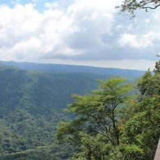
Cima de Cerro Caballo
Location: Distrito de Tacuba
GPS coordinates: 13.86680,-89.95855
Latest update: November 2, 2025 16:55
El Imposible National Park
2.8 km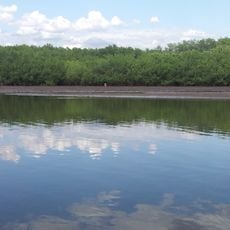
Barra de Santiago
20.4 km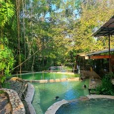
Santa Teresa Hot Springs.
15.6 km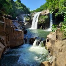
Salto Malacatiupán
22.5 km
Centro para la Cultura y las Artes "Dr. Alfredo Espino"
13.4 km
Labyrinth, 1$ 2022
11.8 km
Río de Montaña
12.6 km
Apaneca Canopy Tour
16.8 km
Xtreme tours buggy
16.8 km
Los Ausoles - geotérmica
16.1 km
Ruinas de la iglesia vieja
4.9 km
Rio Managuita
2.4 km
Border Crossing
17.7 km
La Ceiba Preñada
4.4 km
Observatorio Juvenil de Guaymango
18 km
Centro Turístico Municipal Siloe
13.6 km
Parque El Imposible
4.5 km
Termales de Santa Teresa
15.6 km
Puente viejo Agua Caliente
22 km
Mirador de la Cruz de Ataco
11.5 km
Bust, Work of art
13.7 km
Mirador de Juayúa
21.2 km
Mirador de Apaneca
18.4 km
Crater Viewpoint
18.1 km
Mirador El Pedredon
3.3 km
Scenic viewpoint
13.8 km
Mirador El Mulo
4.6 km
Peña Blanca
5.5 kmReviews
Visited this place? Tap the stars to rate it and share your experience / photos with the community! Try now! You can cancel it anytime.
Discover hidden gems everywhere you go!
From secret cafés to breathtaking viewpoints, skip the crowded tourist spots and find places that match your style. Our app makes it easy with voice search, smart filtering, route optimization, and insider tips from travelers worldwide. Download now for the complete mobile experience.

A unique approach to discovering new places❞
— Le Figaro
All the places worth exploring❞
— France Info
A tailor-made excursion in just a few clicks❞
— 20 Minutes