Atzmoos, protected area of Upper Austria
Location: Bad Ischl
Inception: 1998
GPS coordinates: 47.66561,13.65497
Latest update: November 19, 2025 05:48
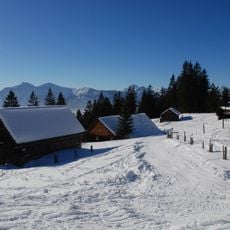
Hütteneckalm
1.5 km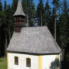
Bergkirche (Salzbergkirche)
1.2 km
Leckenmoos
2.2 km
Großes Langmoos
1.6 km
Kleines Langmoos
2 km
Radriedlmoos
1.9 km
Höllenloch
3 km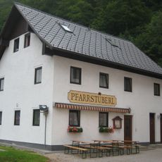
Ehem. Mesnerhaus und Schulhaus
3 km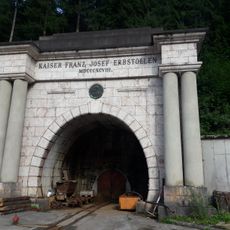
Portal Kaiser-Franz-Josef-Erbstollen
2.7 km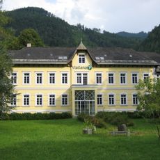
Kurhaus Via Sana, ehem. Kinderhospiz
3 km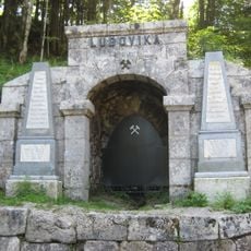
Portal Ludovika-Stollen
1.4 km
Blaschek-Warte
2.5 km
Franz Johann Schilcher
2.5 km
Scenic viewpoint
2.8 km
Work of art, sculpture
2.5 km
Rosas Wasserfälle
2 km
Scenic viewpoint
1.8 km
Wayside shrine
2.5 km
Günther "Jack" Gebetsroither
2.5 km
Wayside cross, Christianity, Catholic church building
2.6 km
Work of art, sculpture
2.6 km
Putz John
2.5 km
Sepp Lichtenegger
1.4 km
Gerhard Limberger
1.4 km
Wayside cross
1.4 km
Waterfall
1.9 km
Waterfall
1.9 km
Waterfall
2.8 kmReviews
Visited this place? Tap the stars to rate it and share your experience / photos with the community! Try now! You can cancel it anytime.
Discover hidden gems everywhere you go!
From secret cafés to breathtaking viewpoints, skip the crowded tourist spots and find places that match your style. Our app makes it easy with voice search, smart filtering, route optimization, and insider tips from travelers worldwide. Download now for the complete mobile experience.

A unique approach to discovering new places❞
— Le Figaro
All the places worth exploring❞
— France Info
A tailor-made excursion in just a few clicks❞
— 20 Minutes