Enable Location

We need your location to show you interesting places around you

Discover nearby places

Find interesting locations and hidden gems around you

Precise directions

Get accurate directions and distances to places

Your location is never shared with other users. It's only used when you tap the location button.

Log in to your account

Start exploring — it's free

Trusted by 62,599 travelers worldwide

Continue with Google
Continue with Apple
or

We will send you a code to connect

By continuing, you accept our Terms and Conditions and our Privacy Policy

Check your inbox

We've sent a pincode in your inbox. Please enter the code below.

Welser Höhenweg

Welser Höhenweg, Mountain hiking trail in Upper Austria, Austria.

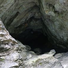
The Welser Höhenweg is a mountain hiking trail in Upper Austria that spans around 54 kilometers from Hinterstoder to Bad Ischl. The path follows the ridge line of the Totes Gebirge between 1,700 and 2,000 meters elevation and connects multiple alpine peaks along its course.

The trail was officially opened in 2020 and quickly established itself as a recognized mountain hiking route in the region. Shortly after its opening, a runner set the speed record for the entire distance at 14 hours and 15 minutes.

Five mountain huts dot the route and serve as social gathering points where hikers rest and connect with other visitors. These huts shape the hiking experience and create places of meeting throughout the high alpine landscape.

The hike demands alpine experience and solid physical fitness due to approximately 3,200 meters of total elevation gain. Sturdy footwear, weather-resistant gear, and early planning are important to walk safely and comfortably through the route.

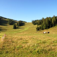
As one of Austria's longest ridge trails, the path runs continuously along the crest of Totes Gebirge from east to west without descending to valleys. This uninterrupted ridge walk offers constantly changing views of the surrounding mountains and creates an immersive high-alpine hiking experience.

The community of curious travelers

AroundUs brings together thousands of curated places, local tips, and hidden gems, enriched daily by 60,000 contributors worldwide.

Start exploring
Location
GPS coordinates
47.69183,14.13894
Latest update
December 14, 2025 12:24
« Welser Höhenweg - Mountain hiking trail in Upper Austria, Austria » is provided by Around Us (aroundus.com). Images and texts are derived from Wikimedia project under a Creative Commons license. You are allowed to copy, distribute, and modify copies of this page, under the conditions set by the license, as long as this note is clearly visible.

Discover hidden gems everywhere you go!

From secret cafés to breathtaking viewpoints, skip the crowded tourist spots and find places that match your style. Our app makes it easy with voice search, smart filtering, route optimization, and insider tips from travelers worldwide. Download now for the complete mobile experience.

Around Us App Screenshot

A unique approach to discovering new places

Le Figaro

All the places worth exploring

France Info

A tailor-made excursion in just a few clicks

20 Minutes

Around Us
Travel Guide & Maps
Download

Send to your phone

QR Code
1

Open the camera app on your mobile.

2

Point at the QR code with your camera. A notification will appear.

3

Tap the notification to open the link.