Pentland Hills, human settlement in Buninyong, Victoria, Australia
Location: Shire of Moorabool
Location: Victoria
Shares border with: Myrniong, Darley, Bacchus Marsh, Maddingley, Ingliston
GPS coordinates: -37.66097,144.30322
Latest update: November 22, 2025 06:02
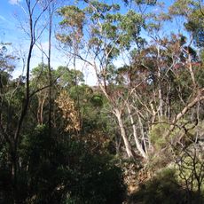
Werribee Gorge State Park
4.1 km
CFA Training College
7.1 km
Northcote Farm School
6.2 km
Pikes Creek Reservoir
7.1 km
Greystones Homestead and Outbuildings
11 km
Picnic Point
4.3 km
Falcons Lookout
3.5 km
Werribee Gorge
4.8 km
Lionhead Beach
4.4 km
Needles Beach
4.1 km
Eastern Viewpoint
4.8 km
Falcons Lookout
1.6 km
Scenic viewpoint
7.8 km
Island Lookout
4.3 km
Bacchus Marsh West Golf Club
9.8 km
Western Bluff Lookout
3.6 km
Ballan Golf Course
10 km
Western Viewpoint
4.4 km
Ingliston Granites
3.3 km
Blackwood Pool
3.8 km
Scenic viewpoint
3.9 km
Scenic viewpoint
4.3 km
Scenic viewpoint
3.5 km
100 Years of ANZAC
4.6 km
Lower Sloss Gully Falls
3.1 km
Sloss Gully Falls
3 km
Gorrocburkghap Falls
5.3 km
Yaloak Falls
6.8 kmReviews
Visited this place? Tap the stars to rate it and share your experience / photos with the community! Try now! You can cancel it anytime.
Discover hidden gems everywhere you go!
From secret cafés to breathtaking viewpoints, skip the crowded tourist spots and find places that match your style. Our app makes it easy with voice search, smart filtering, route optimization, and insider tips from travelers worldwide. Download now for the complete mobile experience.

A unique approach to discovering new places❞
— Le Figaro
All the places worth exploring❞
— France Info
A tailor-made excursion in just a few clicks❞
— 20 Minutes