Community Hall
Location: Kerang
Location: Shire of Gannawarra
GPS coordinates: -35.73352,143.91620
Latest update: November 21, 2025 17:45
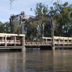
Barham Bridge over Murray River
22.1 km
North Victorian Wetlands
11.6 km
Leaghur State Park
22.9 km
Pioneer Park
22.5 km
Apex Park
6 km
Gannons Weir
31.8 km
Koondrook Weir
20.6 km
Fish Point Weir
32.3 km
Benjeroop Weir
33.2 km
Gunbower Forest
37.3 km
Bael Bael Homestead
18.1 km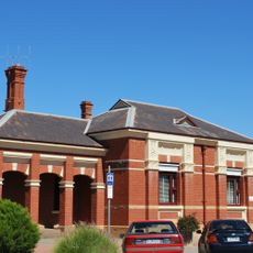
Kerang Post Office
412 m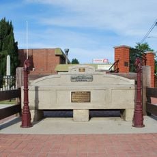
Horse trough
22.4 km
Condidorios Bridge
21.8 km
Koondrook Tram Complex
21.9 km
Barham Golf Resort
23.9 km
Murrabit Golf Course
22.6 km
Kerang Golf Club
2.3 km
Quambatook Golf Club
37.4 km
Cohuna Golf Club
28.1 km
Swimming Pool
73 m
Gateway Visitor Centre
28.8 km
Goods shed
16.5 km
War Memorial
38 km
Memorial
37.8 km
Memorial
236 m
Memorial
242 m
Memorial
33.6 kmReviews
Visited this place? Tap the stars to rate it and share your experience / photos with the community! Try now! You can cancel it anytime.
Discover hidden gems everywhere you go!
From secret cafés to breathtaking viewpoints, skip the crowded tourist spots and find places that match your style. Our app makes it easy with voice search, smart filtering, route optimization, and insider tips from travelers worldwide. Download now for the complete mobile experience.

A unique approach to discovering new places❞
— Le Figaro
All the places worth exploring❞
— France Info
A tailor-made excursion in just a few clicks❞
— 20 Minutes