Freier Seezugang Weißensee
Location: Weißensee
Website: https://gis.ktn.gv.at/leaflet/Fotoseezu/bad_18.pdf
Website: https://gis.ktn.gv.at/leaflet/Fotoseezu/bad_18.pdf
GPS coordinates: 46.71062,13.31617
Latest update: November 21, 2025 09:01
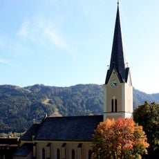
Kirche Techendorf
2.2 km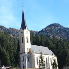
Evangelische Kirche in Weißbriach
5.1 km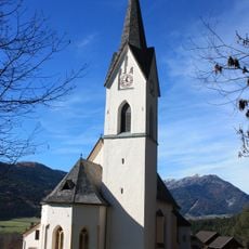
Pfarrkirche Sankt Lorenzen im Gitschtal
4.4 km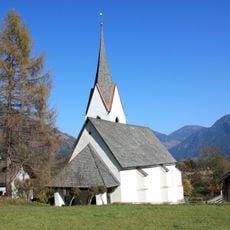
Kath. Filialkirche hl. Andreas Steinfeld
4.8 km
Wegkapelle, Bäckenkapelle
4.7 km
Lacknerkapelle
4.6 km
Kapelle Mariae Heimsuchung
4.9 km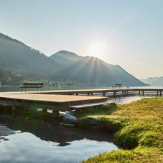
Strandbad
1.6 km
Franz-Josefs-Höhe
4.7 km
Weiße Wand
4.3 km
Scenic viewpoint
1.2 km
Freibad Weissbriach
5.2 km
Goldstein
523 m
Zwergenstadt
2.5 km
Wunderbaum
3.8 km
Weiße Wand
4.3 km
Scenic viewpoint
4.8 km
Scenic viewpoint
3.9 km
Alte Mühle
1.3 km
Picnic table, scenic viewpoint
3.7 km
Scenic viewpoint
3.2 km
Drachsel Bildstöckl
1.5 km
Wayside cross
1.9 km
Mühlrad
900 m
EU-Monument "Wegweiser für Morgen"
1.5 km
Kaiser Franz Josefs Höhe
4.7 km
Wayside cross
1.7 km
Mühlgrabenwasserfall
4.3 kmReviews
Visited this place? Tap the stars to rate it and share your experience / photos with the community! Try now! You can cancel it anytime.
Discover hidden gems everywhere you go!
From secret cafés to breathtaking viewpoints, skip the crowded tourist spots and find places that match your style. Our app makes it easy with voice search, smart filtering, route optimization, and insider tips from travelers worldwide. Download now for the complete mobile experience.

A unique approach to discovering new places❞
— Le Figaro
All the places worth exploring❞
— France Info
A tailor-made excursion in just a few clicks❞
— 20 Minutes