Öffentlicher Seezugang Alexenau
Location: Weyregg am Attersee
GPS coordinates: 47.87281,13.56726
Latest update: November 17, 2025 22:50
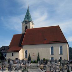
Pfarrkirche Weyregg
3.3 km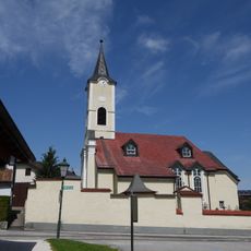
Pfarrkirche hl. Mauritius, Nußdorf am Attersee
3.4 km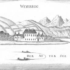
Schloss Weyregg
3 km
Aufhamer Uferwald
3.9 km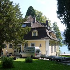
Ehem. Villa Ransonnet, Seminarhotel Grafengut und Bootshaus
3.1 km
Abtsdorf I
3.5 km
Abtsdorf III
3.4 km
Römische Villa Weyregg
3.2 km
Jungsteinzeitliche Pfahlbaustation Nußdorf
3 km
Station Abtsdorf I-III
3.5 km
Station Abtsdorf I-III
3.6 km
Jungsteinzeitliche Pfahlbaustation Weyregg I
3 km
Weißpappel bei der Schiffsanlegestelle in Nußdorf
2.9 km
Grenzhecke von Weyregg
3.3 km
Römische Hafenanlage Weyregg
2.9 km
Badessteg Wasserrettung
3.4 km
Badessteg Wasserrettung
3.4 km
Öffentlicher Seezugang
1 km
Öffentlicher Seezugang
643 m
Attersee Golf Club Weyregg
2.8 km
Födinger Alm
3.9 km
Scenic viewpoint
3.9 km
Scenic viewpoint
3.5 km
Wayside shrine
3.9 km
Wayside shrine, Christianity
3.4 km
Wayside shrine
2.1 km
Wayside cross
3.5 km
Wayside shrine
3.7 kmReviews
Visited this place? Tap the stars to rate it and share your experience / photos with the community! Try now! You can cancel it anytime.
Discover hidden gems everywhere you go!
From secret cafés to breathtaking viewpoints, skip the crowded tourist spots and find places that match your style. Our app makes it easy with voice search, smart filtering, route optimization, and insider tips from travelers worldwide. Download now for the complete mobile experience.

A unique approach to discovering new places❞
— Le Figaro
All the places worth exploring❞
— France Info
A tailor-made excursion in just a few clicks❞
— 20 Minutes