Sahl an Numayyish
Location: محافظة رجال ألمع
GPS coordinates: 17.83219,41.80732
Latest update: November 11, 2025 19:18
Jabal Sawda
76.4 km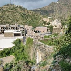
Rijal Almaa
65 km
Asir National Park
78.5 km
متحف دار ألمع للثقافة والتراث
65 km
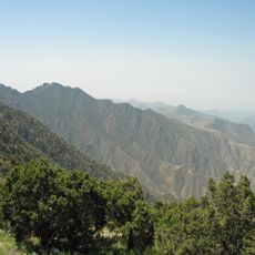
Sahl an Numayyish
617 m
Scenic viewpoint
82.5 km
السودة
77.6 km
The Dabbab Walkway
84.5 km
شاطئ بيش
73.8 km
شاطئ الشقيق
29.1 km
شاطئ بيش
74.3 km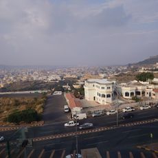
Aseer National Park
83.6 km
Rijal Almaa Heritage Village
65 km
مطل السودة١
76.5 km
High City
83.6 km
Scenic viewpoint
84.1 km
محلات سباكه وكهرباء
73.7 km
مطل العصبة
75.9 km
Scenic viewpoint
84.2 km
Scenic viewpoint
77.4 km
Beautiful rocks
76.3 km
حصن البرك الأثري
51.9 km
قصر ضنكان الأثري
51.3 km
حصن آل مضواح
61.4 km
The 1 km of hiking trail
77.2 km
Start of the hiking trail 6,5 km
72.2 km
Waterfall
79.7 km
شلال المفجر
66.1 kmReviews
Visited this place? Tap the stars to rate it and share your experience / photos with the community! Try now! You can cancel it anytime.
Discover hidden gems everywhere you go!
From secret cafés to breathtaking viewpoints, skip the crowded tourist spots and find places that match your style. Our app makes it easy with voice search, smart filtering, route optimization, and insider tips from travelers worldwide. Download now for the complete mobile experience.

A unique approach to discovering new places❞
— Le Figaro
All the places worth exploring❞
— France Info
A tailor-made excursion in just a few clicks❞
— 20 Minutes